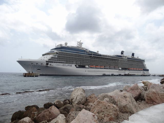
Caribbean Cruise - March 2015
MV Eclipse - Celebrity Cruise Lines
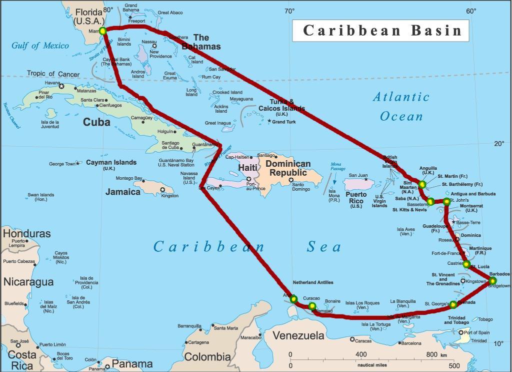
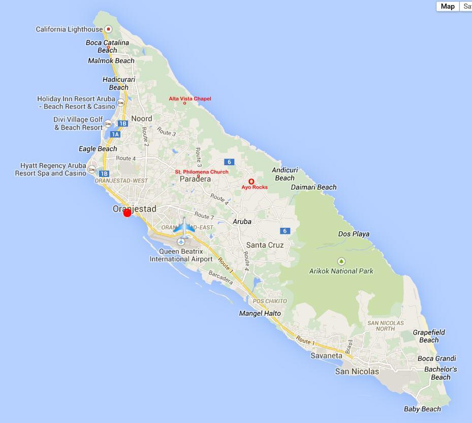
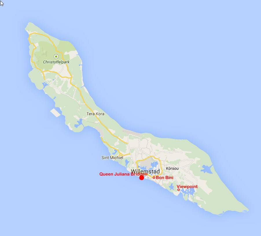
Itinerary
Courtesy of Magellan Geographix
| 15 March 2015 | Miami |
| 16-17 March 2015 | At Sea |
| 18 March 2015 | Oranjestad, Aruba |
| 19 March 2015 | Willemstad, Curaçao |
| 20 March 2015 | At Sea |
| 21 March 2015 | St. George's, Grenada |
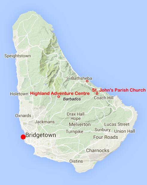
| 22 March 2015 | Bridgetown, Barbados |
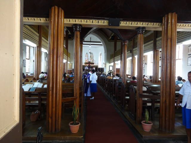
| 23 March 2015 | Castries, St. Lucia |
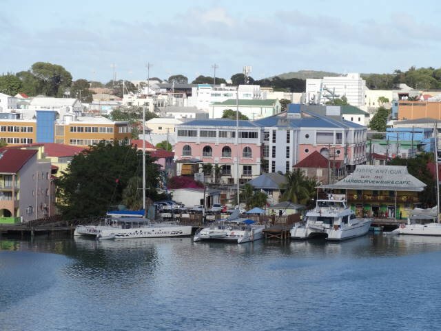
| 24 March 2015 | St. John's, Antigua |
| 25 March 2015 | Basseterre, St. Kitts |
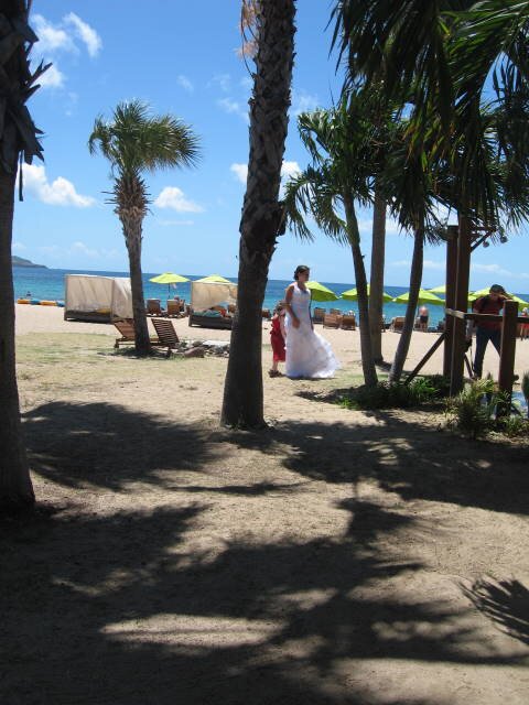
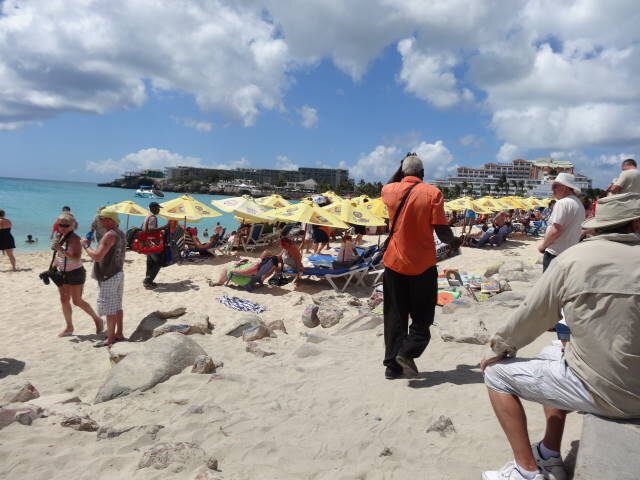
| 26 March 2015 | Philipsburg, St. Maarten |
| 27-28 March 2015 | At Sea |
| 29 March 2015 | Miami |
We drove from home to Miami.
Much of the background information included here has been garnered from various internet sources, mostly Wikipedia.We had only visited Curaçao, the Grand Caymans, and Jamaica in the Caribbean before so most of the ports were new to us.
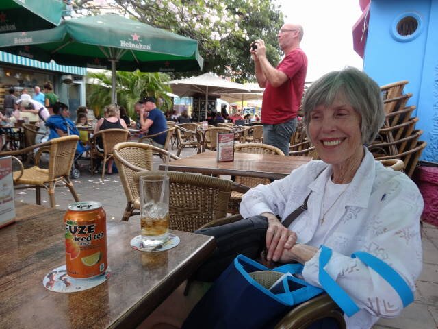
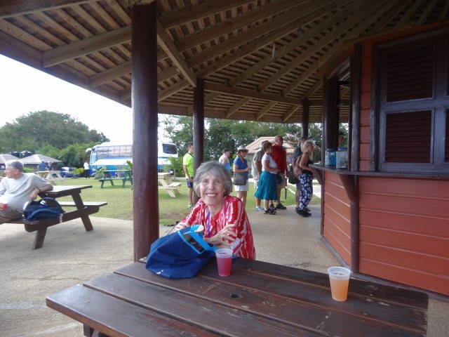
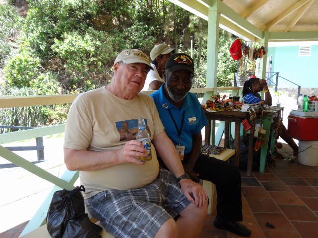
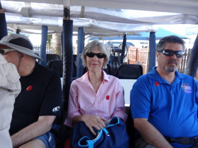
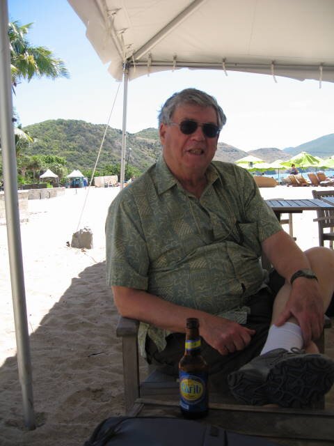
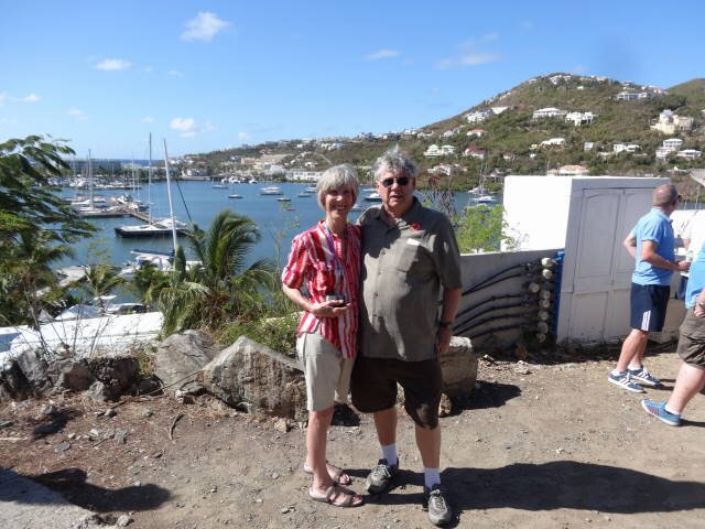
This was our first cruise on Celebrity. We were very pleased with the room (8110) and the meals (we felt that the dinners in the main dining room, Moonlight Sonata, overall were the best on any cruise line we have been on).
Our dinner waiters were Charniel from
Manila, Philippines, and our assistant waiter was a young man Petar from
southern Croatia. They were undoubtedly the best and friendliest waiters who
have ever served us.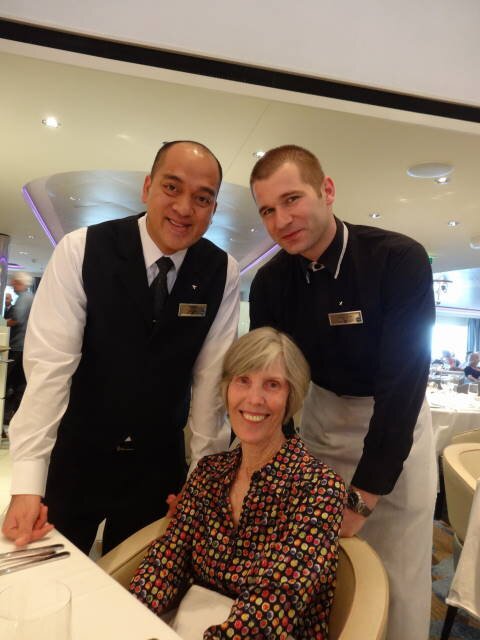
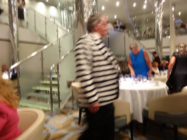
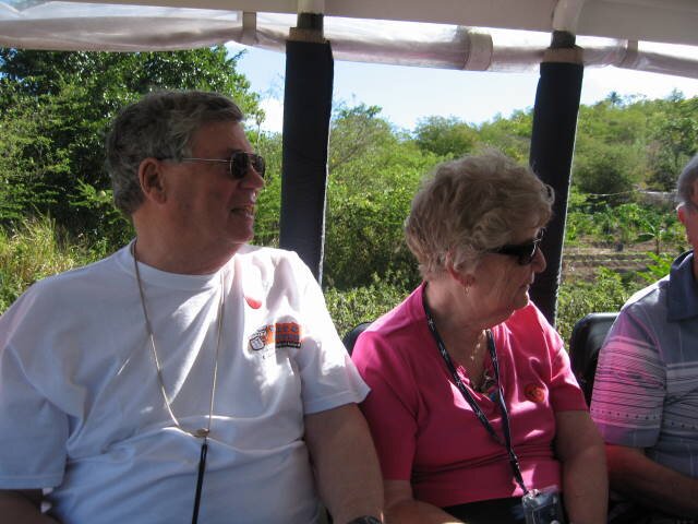
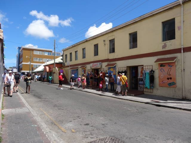
There were some disappointments as well. The internet was essentially useless. It took forever to connect and even more to update. A few of the bars advertise Happy Hour but, unlike other lines where all drinks are 2 for 1, on Celebrity it is only for the drink of the day. Celebrity charges for bottled water, even when going on a ship's tour. The Mast Grill has excellent hamburgers but only a few tables on which to sit (I complained and they did double the tables to about 10). Diners were expected to sit on chaise lounges balancing their plates and drinks. Other lines had tables all along the rails on the pool deck, Celebrity only has chaise lounges. Celebrity still has formal nights where diners are expected to wear tuxedos, suits, cocktail dresses, or sports coats with slacks. In today's world of airline restrictions on luggage, this makes no sense. Why carry a suit, dress shoes, etc., to placate a few who like to show off? No other cruise line that we have sailed still have these stupid formal nights. One gent wore a black and white striped sport coat each formal night which reminded me of the prison garb that is still used at places where common sense rules, I assume as a medium to protest (sorry about the blurriness). Kudos to this gent!
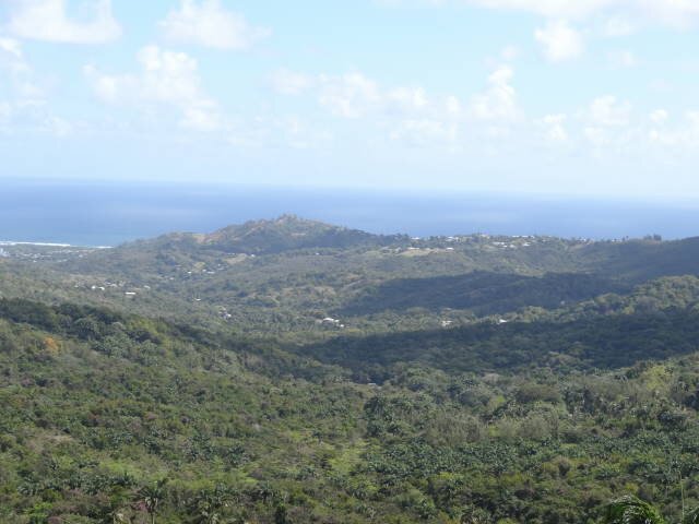
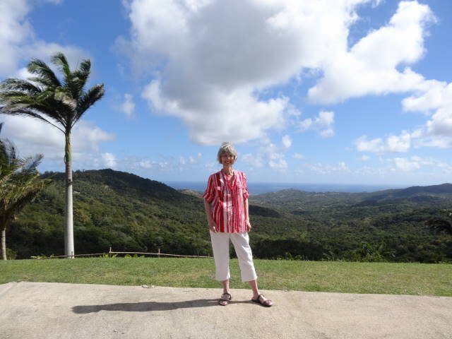
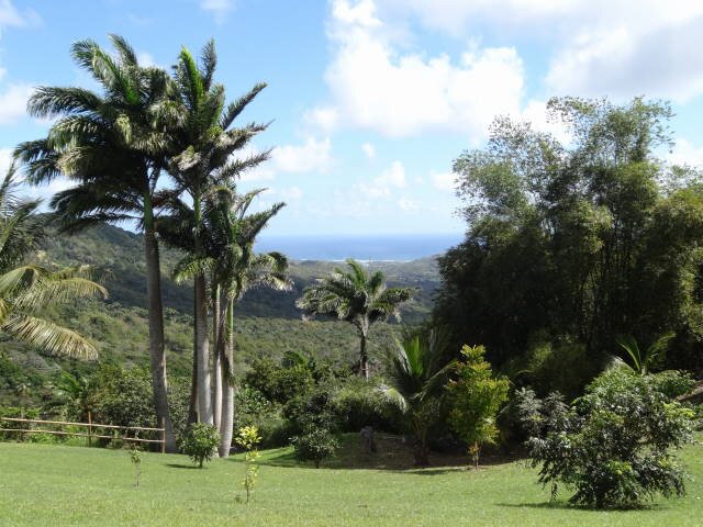
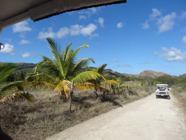
All of islands are heavily dependent upon tourism for their economies. Aruba and Curaçao are flat desert-like. The Antilles islands and Barbados are very lush and green, most hilly to mountainous. Our favorites were Barbados and St. Kitts. I don't think we would bother with another Caribbean cruise given that we do not like the hot sun and the islands are not that comfortable due to the exorbitant prices and the overall conditions of most of the islands.
ARUBA
Oranjestad, Aruba
BACKGROUND:
Aruba is an island in the southern Caribbean Sea, located about 1,600 kilometres (990 mi) west of the Lesser Antilles and 29 kilometres (18 mi) north of the coast of Venezuela. It measures 32 kilometres (20 mi) long from its northwestern to its southeastern end and 10 kilometres (6 mi) across at its widest point. Aruba is one of the four constituent countries that form the Kingdom of the Netherlands, along with the Netherlands, Curaçao and Sint Maarten. The citizens of these countries all share a single nationality: Dutch. Aruba has no administrative subdivisions, but, for census purposes, is divided into eight regions. Its capital is Oranjestad. Unlike much of the Caribbean region, Aruba has a dry climate and an arid, cactus-strewn landscape. It has a land area of 179 km2 (69.1 sq mi) and is densely populated, with a total of 102,484 inhabitants at the 2010 Census.
Aruba's first inhabitants are thought to have been Caquetíos Amerinds from the Arawak tribe, who migrated there from Venezuela to escape attacks by the Caribs. Fragments of the earliest known Indian settlements date back to 1000 AD. As sea currents made canoe travel to other Caribbean islands difficult, Caquetio culture remained more closely associated with that of mainland South America.
Europeans first learned of Aruba following the explorations for Spain by Amerigo Vespucci and Alonso de Ojeda in the summer of 1499. Though Vespucci boasted of discovering the island, Ojeda was likely first, learning of it from natives of nearby islands. Both described Aruba as an "island of giants", remarking on the comparatively large stature of the native Caquetíos compared to Europeans. Vespucci and Ojeda's tales spurred interest in Aruba, and Spaniards soon colonized the island. Aruba was colonized by Spain for over a century. In 1508, the Spanish Crown appointed Alonso de Ojeda as its first Governor of Aruba, as part of Nueva Andalucía.
Since 1636, Aruba has been under Dutch administration, initially governed by Peter Stuyvesant, later appointed to New Amsterdam (New York City). Stuyvesant was on a special mission in Aruba in November and December 1642. The island was included under the Dutch West India Company (W.I.C.) administration, as "New Netherland and Curaçao," from 1648 to 1664. The Dutch took control 135 years after the Spanish, leaving the Arawaks to farm and graze livestock, and used the island as a source of meat for other Dutch possessions in the Caribbean.[citation needed]
In August 1947, Aruba presented its first Staatsreglement (constitution), for Aruba's status aparte as an autonomous state within the Kingdom of the Netherlands. By 1954, the Charter of the Kingdom of the Netherlands was established, providing a framework for relations between Aruba and the rest of the Kingdom. In March 1977, the first Referendum for Self Determination was held with the support of the United Nations; 82% of the participants voted for independence. In March 1983, Aruba reached an official agreement within the Kingdom for its independence, to be developed in a series of steps as the Crown granted increasing autonomy. In August 1985 Aruba drafted a constitution that was unanimously approved. On 1 January 1986, after elections were held for its first parliament, Aruba seceded from the Netherlands Antilles; it officially became a country of the Kingdom of the Netherlands.
OUR VISIT:
We went ashore and decided to take a tour of the island as we had visited
Oranjestad before. We found a gent named Didi and joined his bus tour. He was an
older fellow who had worked in hotels in Aruba for years before launching his
tour business. We has a native Aruban, probably of mixed Dutch and maybe Spanish
ancestry. He was a very entertaining and knowledgeable person. He told us that
he was raised a Catholic like 80% of the Arubans. We was baptized, received his
first communion, was confirmed, and was married to a Catholic girl in the
Church. Later things happened and he divorced using a Catholic lawyer. He
remarried two other times, both ending in divorce. He was now single. The tour
was about 2.5 hours and we all had the option to be dropped off at one of the
beach resorts afterwards and Didi would return in 2.5 hours to return those to
the ship.
Turns out the day was a holiday so most stores and shops were closed. On
March 18 1986, Aruba separated from the Netherlands Antilles, adopting their own
flag and national anthem. Most cars we saw on the road were decorated with their
national flag much like our Southern football partisans do on game days.
The official language is Dutch though many speak the local dialect
Papiamento which was derived from African dialects, Dutch, English, French, and
Portuguese. English is taught in the schools and after the fifth grade, students
can take French or German.
The island is very desert-like once you leave Oranjestad. They have
rattlesnakes and boa constrictors on the island. Nothing is produced there so
everything is imported (except I found out later that they have a good
locally produced beer Balashi). The major money-maker on the island is tourism,
the season of which runs from October to May. There are many major hotels and
resorts along the coast and we saw multitudes of people at them. I personally
would get bored rather early there since I am not one to lie around a beach and
soak up sunshine.
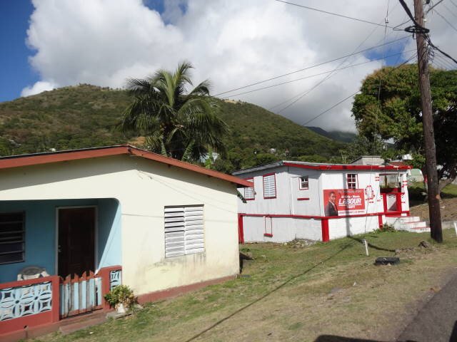
Aruba people typically make about $1200 a month. They have a very generous
pension and health program paid through taxes. Government owns most of the land,
citizens can lease the land or buy it outright. Homes are very expensive there
as is water and electricity. He said if you fail to make your monthly payment,
the water and/or electricity is cut off.
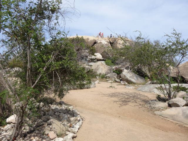
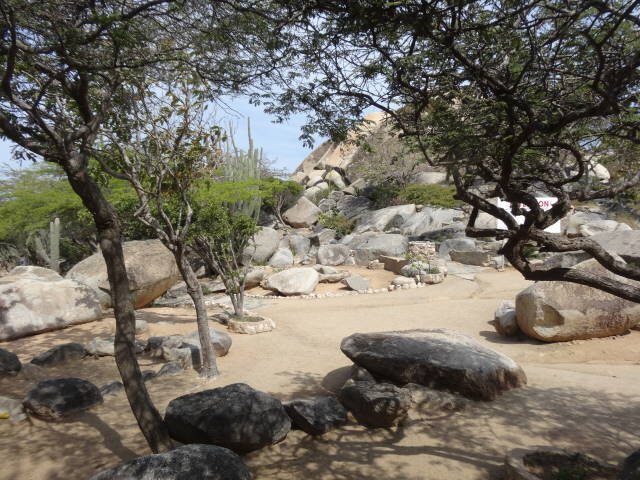
We saw most of the island. The island is referenced into for sections,
emanating from a mountain that they call The Haystack. The island was volcanic
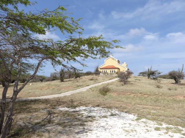
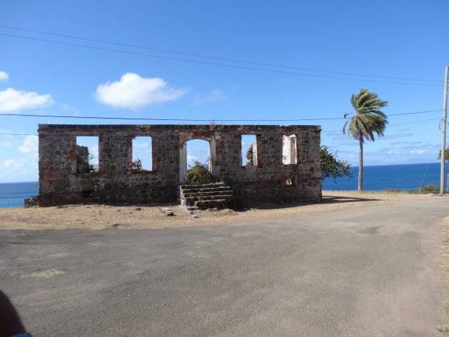
in origin. We passed a large church called St. Philomena. Every Easter season,
about 15000 pilgrims walk from there or their local parish churches to a small
chapel on the north end of the island where they do the Stations of the cross.
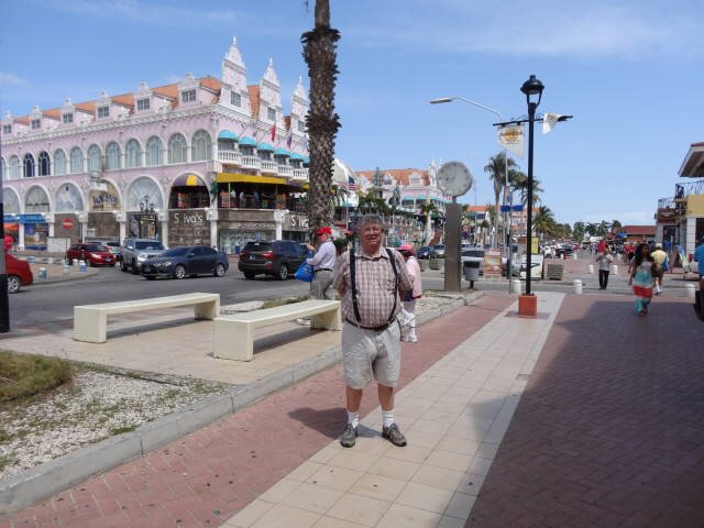
After our tour, we went back to the ship for lunch. Afterwards, we
disembarked again and walked into town. Most of the shops were diamond and
jewelry stores which were open for the cruise ship. The sun was bright and the
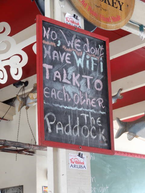
temperature was hot. We finally found a bar called The Paddock which we had
visited on our last stop there. They had a cute sign on a blackboard "No,
we don't have WiFi. Talk to each other." We had a couple of the local beers
while Marilyn had a Coke. Marilyn commented how many men walking by looked
longingly at the bar's patio but most had to continue on as their wives weren't
interested in stopping.
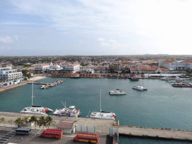
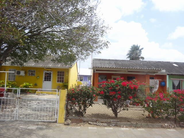
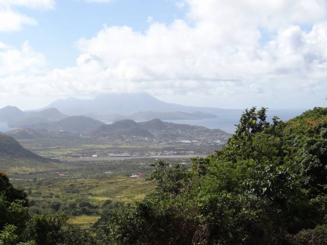
Oranjestad from the ship
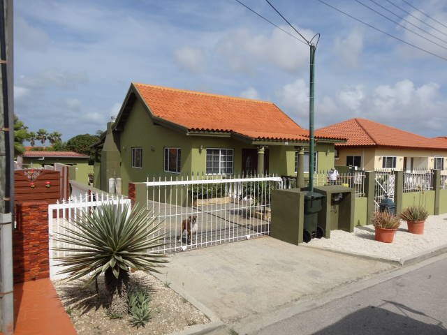
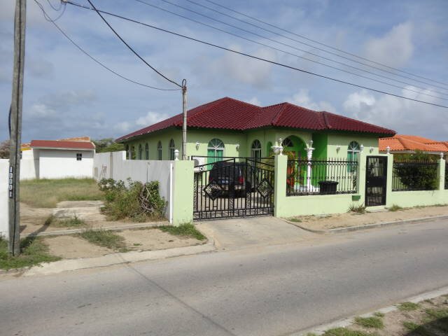
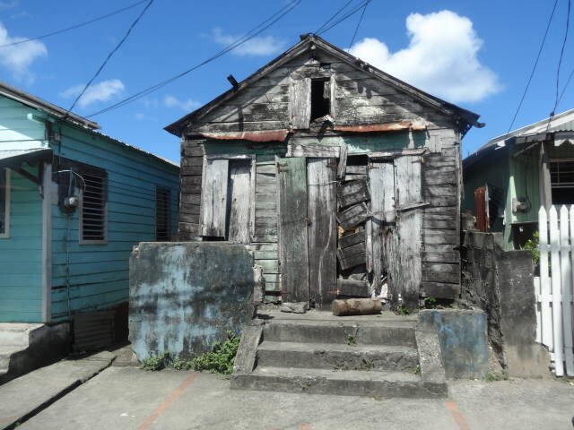
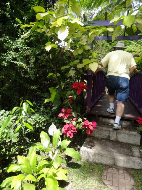
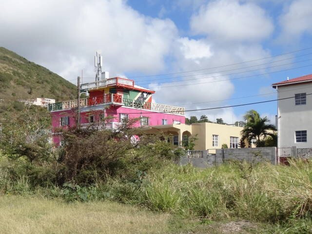
Homes in Aruba
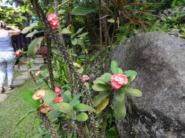
Ayo Rocks Park
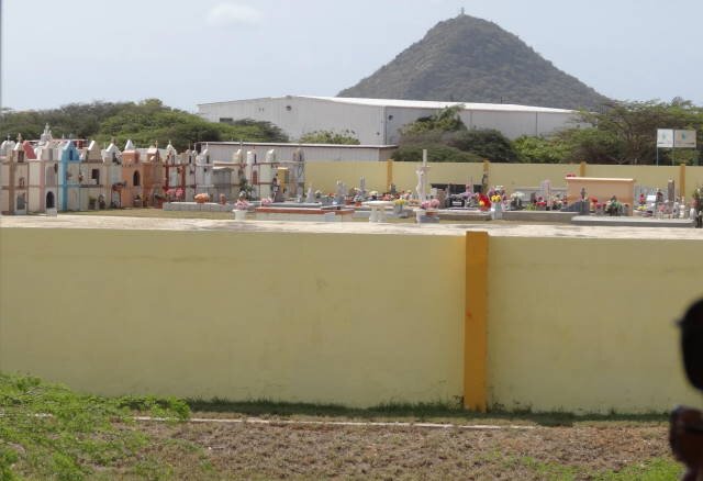
St. Philomena Chutch -- Cemetary with the Haystack in the background
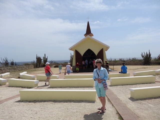
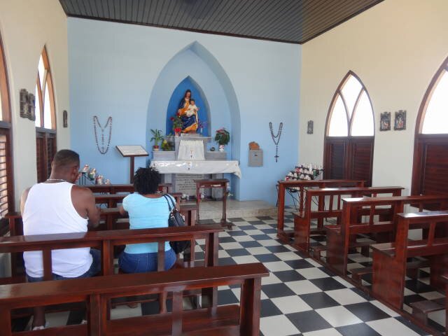
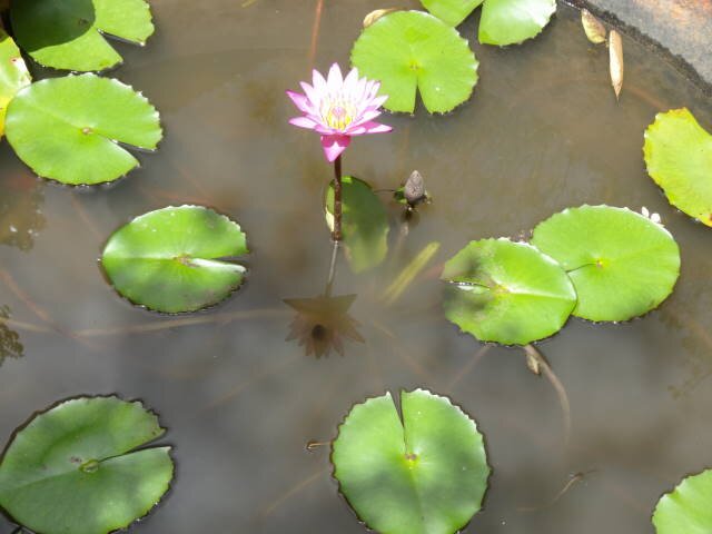
Alta Vista Chapel
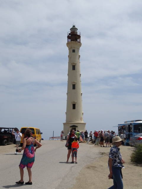
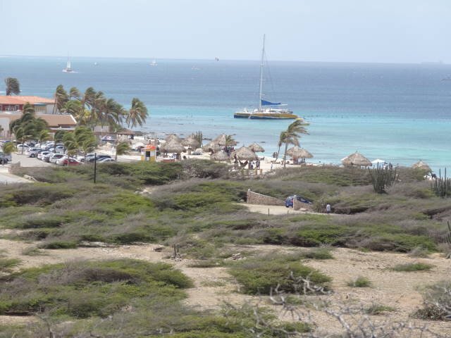
California Lighthouse -- Arashi Beach from lighthouse
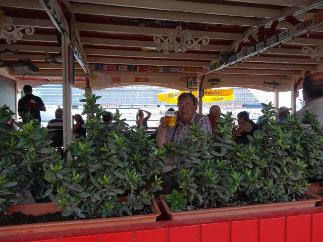
Lloyd G. Smith Blvd -- The Paddock (with the Eclipse in the background) sampling Balashi Beer
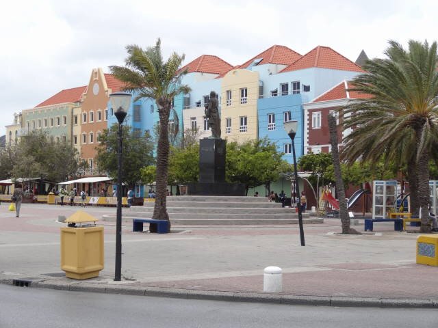
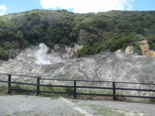
CURAÇAO
Willemstad, Curaçao
BACKGROUND:
Curaçao is an island in the southern Caribbean Sea, north of the Venezuelan coast, that forms part of the Dutch Caribbean. The Country of Curaçao which includes the main island and the small, uninhabited island of Klein Curaçao ("Little Curaçao"), is a country of the Kingdom of the Netherlands. It has a population of over 150,000 on an area of 444 km2 (171 sq mi) and its capital is Willemstad.
Prior to 10 October 2010, when the Netherlands Antilles was dissolved, Curaçao was administered as the Island Territory of Curaçao, one of five island territories of the former Netherlands Antilles.
The original inhabitants of Curaçao were Arawak peoples. Their ancestors had migrated to the island from the mainland of South America. The first Europeans recorded as seeing the island were members of a Spanish expedition under the leadership of Alonso de Ojeda in 1499. The Spaniards enslaved most of the Arawak as their labour force. They sometimes forcibly relocated the survivors to other colonies where workers were needed. In 1634, after the Netherlands achieved independence from Spain, Dutch colonists started to occupy the island. European powers were trying to get bases in the Caribbean.
The Dutch West India Company founded the capital of Willemstad on the banks of an inlet called the 'Schottegat'. Curaçao had been ignored by colonists, because it lacked gold deposits. The natural harbour of Willemstad proved to be an ideal spot for trade. Commerce and shipping — and piracy—became Curaçao's most important economic activities. In addition, in 1662 the Dutch West India Company made Curaçao a centre for the Atlantic slave trade, often bringing slaves here for sale elsewhere in the Caribbean.
In the Franco-Dutch War, Count Jean II d'Estrées planned to attack Curaçao. His fleet — 12 men of war, 3 fireships, 2 transports, a hospital ship, and 12 privateers — met with disaster, losing 7 men of war and 2 other ships when they struck reefs off the Las Aves archipelago. They had made a serious navigational error, hitting the reefs on 11 May 1678, a week after setting sail from Saint Kitts. Curaçao marked the events by a Day of Thanksgiving, celebrated for decades into the 18th century, to commemorate the island's fortunate escape from being invaded by the French.
In 1795, a major slave revolt took place under the leaders Tula Rigaud, Louis Mercier, Bastian Karpata, and Pedro Wakao. Up to 4000 slaves on the northwest section of the island revolted. Over a thousand of the slaves were involved in heavy gunfights. After a month, the slave owners suppressed the revolt.[
During the 18th and 19th centuries, the island changed hands among the British, the French, and the Dutch several times. In the early 19th century, Portuguese and Lebanese migrated to Curaçao attracted by the business opportunities. Stable Dutch rule returned in 1815, at the end of the Napoleonic wars, when the island was incorporated into the colony of Curaçao and Dependencies.
Historically, Dutch was not widely spoken on the island outside of colonial administration; its use increased in the late 19th and early 20th century. Students on Curaçao, Aruba, and Bonaire were taught predominantly in Spanish up until the late 19th century. There were also efforts to introduce bilingual popular education in Dutch and Papiamentu in the late 19th century.
In the early 20th century, Dutch was made the sole language of instruction in the educational system. Papiamentu, the local Creole language, was tentatively reintroduced in the school curriculum during the mid-1980s.
Curaçao gained self-government on 1 January 1954, as an island territory of the Netherlands Antilles. On 2 July 1984, the 30th anniversary of the first elected Island Council, the council inaugurated the National Flag and the official anthem. Since then, the movement to separate the island from the Antillean federation has steadily become stronger. In the 2000s, the political relationship with the other islands of the Netherlands Antilles, and with the Netherlands, came under discussion again. In a referendum held on 8 April 2005, the residents voted for separate status outside the Netherlands Antilles, similar to Aruba. They rejected the options for full independence, becoming part of the Netherlands, or retaining the status quo.
On 1 July 2007, the island of Curaçao was due to become a country within the Kingdom of the Netherlands. On 28 November 2006, this was delayed when the island council rejected a clarification memorandum on the process. A new island council ratified this agreement on 9 July 2007. On 15 December 2008, Curaçao was scheduled to become a separate country within the Kingdom of the Netherlands (as Aruba and the Netherlands Antilles were). A non-binding referendum on this plan took place in Curaçao on 15 May 2009, in which 52 percent of the voters supported these plans. The dissolution of the Netherlands Antilles came into effect on 10 October 2010. Curaçao became a country within the Kingdom of the Netherlands, with the Kingdom retaining responsibility for defence and foreign policy. The Kingdom was also to oversee the island's finances under a debt-relief arrangement agreed between the two divisions.
OUR VISIT:
We had no plans in advance for our visit. But after our pleasant
experience with the local tour on Aruba, we decided to do the same here. We
ultimately joined a group in a van with a female driver and a very knowledgeable
guide named Ruth for a two hour tour of the island.
Ruth told us the islanders are 80% Catholic, 5% Jewish, 5% Protestant, and
the remaining 10%, various other religions.
The island is semi-desert and very flat, though there is much more green
than Aruba. They do produce some local vegetables and fruits but most items are
imported like Aruba.
We drove across the Queen Juliana Bridge which allowed a good view of both
parts of Willemstad.
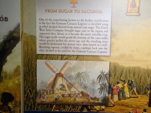
Then we went to te Bon Bini distillery in Landhuis Chobolobo. This is
where the familiar blue liqueur Curaçao is made. It actually is clear ethyl
alcohol distilled from sugar cane. Various flavors and colors are added to make
the distinctive drinks. After the tour we were treated to samples of the orange,
chocolate, rum raisin, and coffee flavors. The building has an exhibit with
scenes depicting the history of the island and the distilling process.
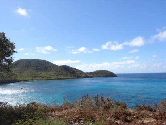
We then proceeded southeast stopping at a viewpoint where we could see
Lamaya Beach and the surrounding area. There was a huge ugly ship moored in the
mouth of the Caracas Bay. It was the Castoro 7, a pipe layer platform
registered in Panama. She will install the Dragon-CIGMA (Complejo Industrial
Gran Mariscal Ayacucho) gas export pipeline. The 110 km (68.3 mi) long, 36-in.
(91-cm) sea line will connect the Dragon gas platform, about 50 km (31 mi) off
Venezuela's northeast coast, to the CIGMA complex near Guiria, in the Gulf of
Paria, Sucre state in Venezuela. The Castoro 7 pipelay vessel will
perform most of the offshore activities.
After the island tour, we asked to be dropped off in town. The town is
split in two with normally an old floating bridge (Emma) across the channel for
people to walk across but the bridge was under repair so a ferry took people
across at no charge.
The capital of Willemstad is more like a regular town which regular shops
and restaurants, unlike Oranjestad which seemed mostly jewelry shops. We stopped
at one outside patio place where Marilyn had a coke and I had a local beer
Chill. Chill reminded me of Corona, a pretty mild beer. We walked around
the town and finally decided to return to the ship. We then walked down to the
St. Anne Bay where normally the Queen Emma floating bridge connects us to the
port area. The bridge was under repair so the city runs a free ferry across.
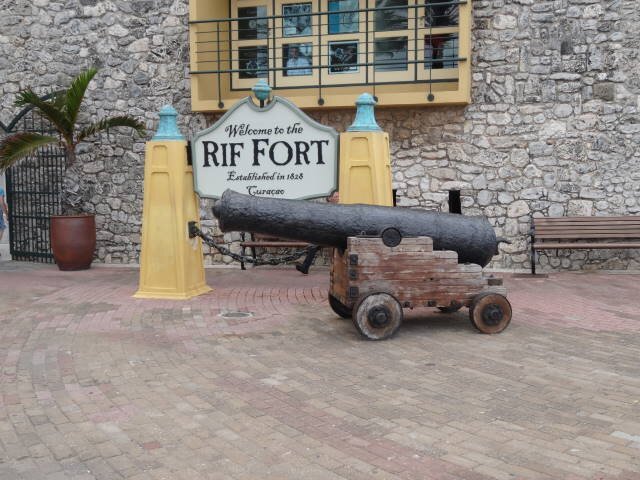
The way back went through the old Rif Fort which now has been converted to
very nice shopping mall with many shops and restaurants. We stopped at one
called Salt & Pepper where we had a couple of Presidente beers from the
Dominican Republic and some tapas of goat cheese and serrano ham. Very good and
reasonably priced!
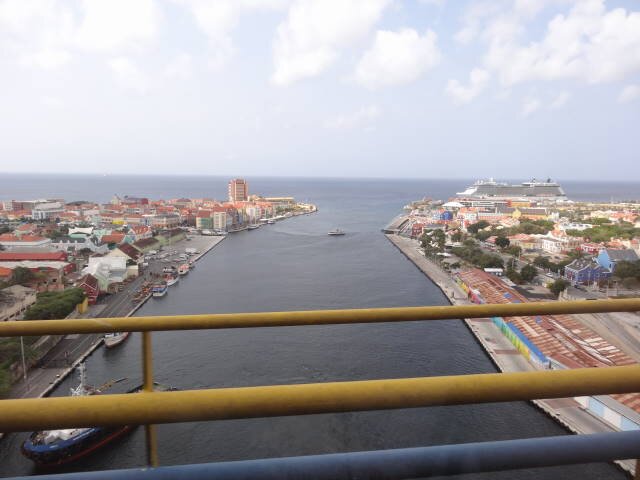
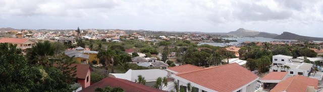
Willemstad and Eclipse from the Queen Ju;iana Bridge
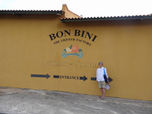
Bon Bini distillery
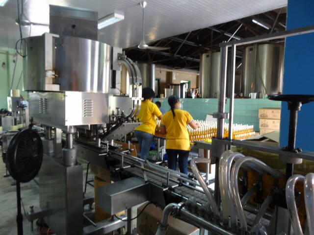
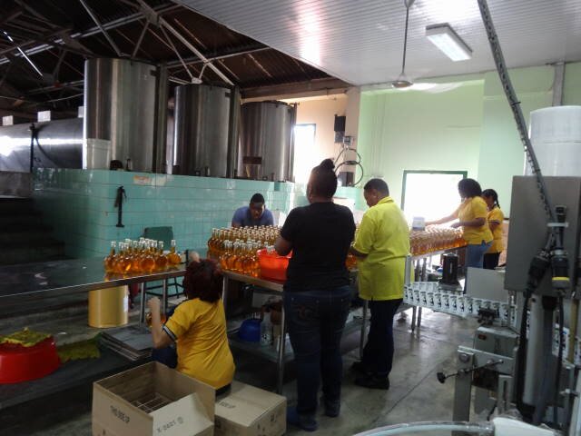
Bon Bini bottling process
Panorama of Lamaya Beach
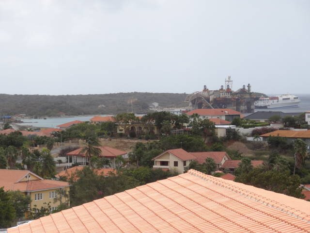
Castoro 7 pipe laying platform -- Homes near Willemstad
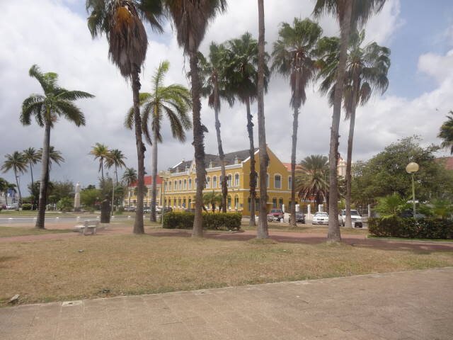
Willemstad -- Queen Wilhelmina Park
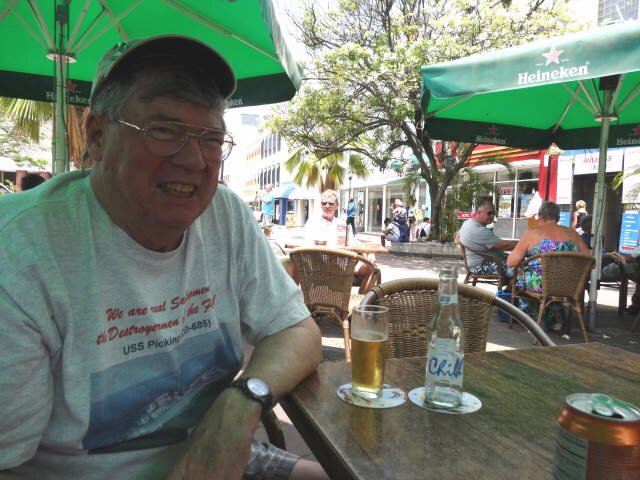
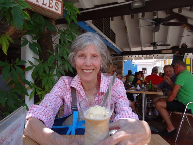
Cool drinks in Willemstad
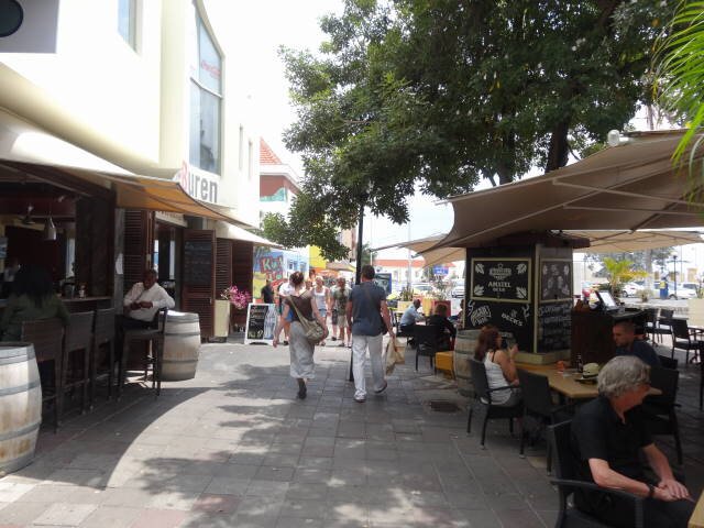
Breedestraat in Willemstad
At the ferry start -- On the ferry
GRENADA
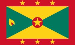
St. Georges, Grenada
BACKGROUND:
Grenada is an island country consisting of Grenada itself and six smaller islands at the southern end of the Grenadines in the southeastern Caribbean Sea. Grenada is located northwest of Trinidad and Tobago, northeast of Venezuela, and southwest of Saint Vincent and the Grenadines. Grenada is also known as the "Island of Spice" because of the production of nutmeg and mace crops of which it is one of the world's largest exporters. Its size is 344 km2 (133 sq mi), with an estimated population of 110,000. Its capital is St. George's.
On March 17, 1649, a French expedition of 203 men from Martinique led by Jacques du Parquet founded a permanent settlement on Grenada. Within months this led to conflict with the local islanders which lasted until 1654 when the island was completely subjugated by the French. Those indigenous islanders who survived either left for neighboring islands or retreated to remoter parts of Grenada where they were marginalised—the last distinct communities disappeared during the 1700s. Warfare continued during the 1600s between the French on Grenada and the Caribs of present-day Dominica and St. Vincent and the Grenadines. The French named the new French colony La Grenade, and the economy was initially based on sugar cane and indigo. The French established a capital known as Fort Royal (later St. George). To shelter from hurricanes the French navy would often take refuge in the capital's natural harbour, as no nearby French islands had a natural harbour to compare with that of Fort Royal. The British captured Grenada during the Seven Years' War in 1762.
Grenada was formally ceded to Britain by the Treaty of Paris in 1763. The French re-captured the island during the American War of Independence, after Comte d'Estaing won the bloody land and naval Battle of Grenada in July 1779. However the island was restored to Britain with the Treaty of Versailles in 1783. Britain was hard pressed to overcome a pro-French revolt in 1795–96 led by Julien Fedon.
Nutmeg was introduced to Grenada in 1843 when a merchant ship called in on its way to England from the East Indies. The ship had a small quantity of nutmeg trees on board which they left in Grenada, and this was the beginning of Grenada's nutmeg industry that now supplies nearly 40% of the world's annual crop.
In 1877, Grenada was made a Crown colony.
In 1950, Eric Gairy founded the Grenada United Labour Party, initially as a trades union, which led the 1951 general strike for better working conditions. This sparked great unrest—so many buildings were set ablaze that the disturbances became known as the "red sky" days—and the British authorities had to call in military reinforcements to help regain control of the situation. On October 10, 1951, Grenada held its first general elections on the basis of universal adult suffrage, with Gairy's party winning six of the eight seats contested. From 1958 to 1962 Grenada was part of the Federation of the West Indies. On March 3, 1967, Grenada was granted full autonomy over its internal affairs as an Associated State.
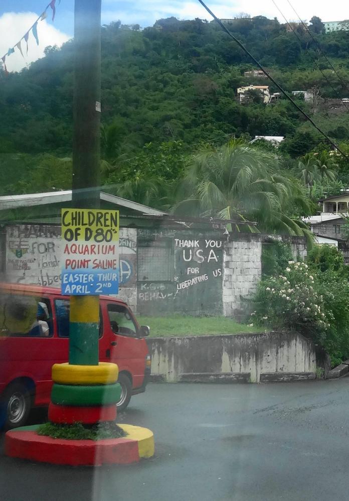
Independence was granted on February 7, 1974. Civil conflict gradually broke out between the government and some opposition parties including the New Jewel Movement (NJM). The incumbants won elections in 1976, but the opposition did not accept the result, accusing it of fraud. In 1979, the New Jewel Movement under Maurice Bishop launched a paramilitary attack on the government resulting in its overthrow. The constitution was suspended and Bishop's "People's Revolutionary Government" (PRG) ruled subsequently by decree. Cuban doctors, teachers, and technicians were invited in to help develop health, literacy, and agriculture over the next few years.
Some years later a dispute developed between Bishop and certain high-ranking members of the NJM. Though Bishop cooperated with Cuba and the USSR on various trade and foreign policy issues, he sought to maintain a "non-aligned" status. Bishop had been taking his time making Grenada wholly socialist, encouraging private-sector development in an attempt to make the island a popular tourist destination. Hardline Marxist party members, including Communist Deputy Prime Minister Bernard Coard, deemed Bishop insufficiently revolutionary and demanded that he either step down or enter into a power-sharing arrangement. On October 19, 1983, Bernard Coard and his wife Phyllis, backed by the Grenadian Army, led a coup against the government of Maurice Bishop and placed Bishop under house arrest. These actions led to street demonstrations in various parts of the island. Bishop had enough support from the population that he was eventually freed after a demonstration in the capital. When Bishop attempted to resume power, he was captured and executed by soldiers along with seven others, including government cabinet ministers. The Coard regime then put the island under martial law. After the execution of Bishop, the People's Revolutionary Army (PRA) formed a military government with General Hudson Austin as chairman. The army declared a four-day total curfew, during which (it said) anyone leaving their home without approval would be shot on sight.
The overthrow of a moderate government by one which was strongly pro-communist worried U.S. President Ronald Reagan. Particularly worrying was the presence of Cuban construction workers and military personnel who were building a 10,000-foot (3,000 m) airstrip on Grenada. Bishop had stated the purpose of the airstrip was to allow commercial jets to land, but U.S. military analysts argued that the only reason for constructing such a long and reinforced runway was so that it could be used by heavy military transport planes. The contractors, American and European companies, and the EEC, which provided partial funding, all claimed the airstrip did not have military capabilities. Reagan was worried that Cuba – under the direction of the Soviet Union – would use Grenada as a refueling stop for Cuban and Soviet airplanes loaded with weapons destined for Central American communist insurgents.
On October 25, 1983, combined forces from the United States and from the Regional Security System (RSS) based in Barbados invaded Grenada in an operation codenamed Operation Urgent Fury. The U.S. stated this was done at the behest of Prime Minister Eugenia Charles of Dominica. While the Governor-General of Grenada, Sir Paul Scoon, later stated that he had also requested the invasion, it was highly criticised by the governments of Britain, Trinidad and Tobago, and Canada. The United Nations General Assembly condemned it as "a flagrant violation of international law" by a vote of 108 in favor to 9, with 27 abstentions. The United Nations Security Council considered a similar resolution, which failed to pass when vetoed by the United States.
After the invasion of the island nation, the pre-revolutionary Grenadian constitution came into operation once again. Eighteen members of the PRG and the PRA (army) were arrested after the invasion on charges related to the murder of Maurice Bishop and seven others. The eighteen included the top political leadership of Grenada at the time of the execution as well as the entire military chain of command directly responsible for the operation that led to the executions. Fourteen were sentenced to death, one was found not guilty and three were sentenced to 45 years in prison. The death sentences were eventually commuted to terms of imprisonment. Those in prison have become known as the Grenada 17.
When U.S. troops withdrew from Grenada in December 1983, Nicholas Brathwaite of the National Democratic Congress was appointed prime minister of an interim administration by Scoon until elections could be organized. The first democratic elections since 1976 were held in December 1984 and were won by the Grenada National Party under Herbert Blaize who served as prime minister until his death in December 1989. Ben Jones succeeded Blaize as prime minister and served until the March 1990 election, which was won by the National Democratic Congress under Nicholas Brathwaite who returned as prime minister for a second time until he resigned in February 1995. He was succeeded by George Brizan who served until the June 1995 election which was won by the New National Party under Keith Mitchell who went on to win the 1999 and 2003 elections and served for a record 13 years until 2008.
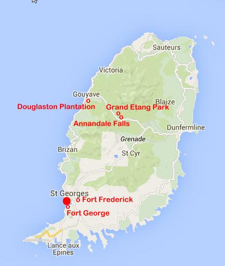
OUR VISIT
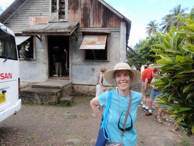
We arrived on Saturday so most shops were open and many people were seen
in towns and at homes. Unlike Aruba and Curacao, the island is mountainous and
very lush and green.
We purchased a 3.5 hour land tour of the island from Celebrity. We went up
the west (Caribbean) coast to Gouyave where we started across the island to the
Atlantic side. The drive was interesting but the driver/guide did not make photo
stops. He would pull over to the side of the road and we would have to take
photos through the windows. Unfortunately, there was some rain and the windows
were often they were often streaked with rain drops. The roads are narrow and it
was interesting when vehicles came from the other direction.
The island is 60% Catholic mainly due to its previous status as a French
colony. There are large numbers of Anglicans and we saw many small Bible
Christian churches.
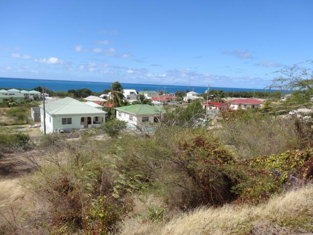
We saw many homes, ranging from very small shacks to rather large two
story homes. There were small towns with homes but many of the homes were in
isolated areas.
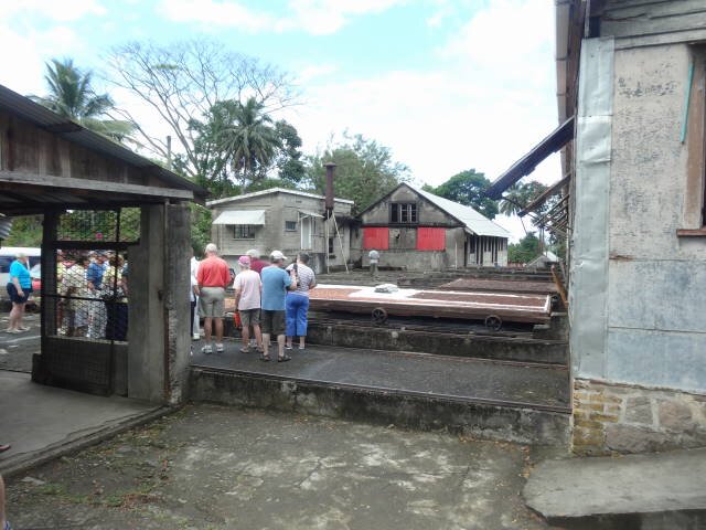
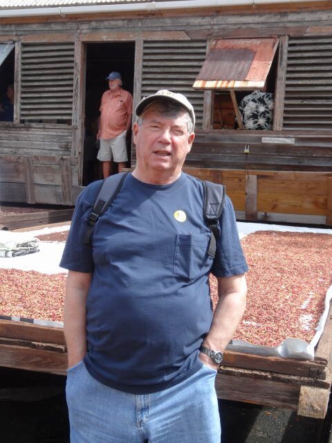
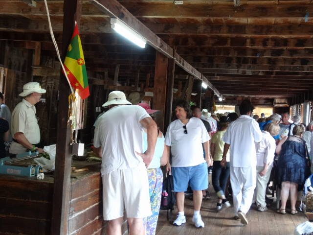
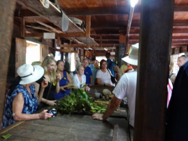
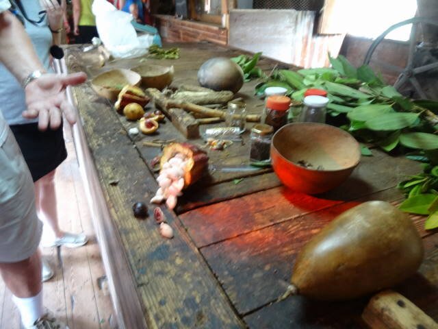
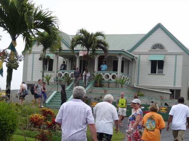
Our first stop was Douglaston Plantation near Gouyave where they grow and
process many spices that are raised on the island. They had large wheeled trays
where the spices dry outside up to 3 weeks. There is a sales shed where they
sell packaged spices and demonstrate processing of spices. One of the items
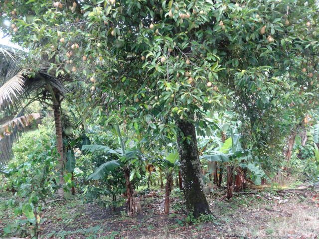
processed was cacao. The beans from the pod are white!
From there we proceeded through the rain forest (the island gets 120
inches of rain a year, usually from June through December). This is the dry
season but we had light rain a good part of the day.
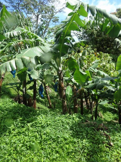
Many small farmers raise crops including spices and cacao for export. The
island is very fertile and many food crops are raised. We saw areas with
bananas, plantains, nutmeg, and cacao trees are cultivated. Interestingly,
bunches of bananas for export are bagged in blue plastic covers on the trees to
protect the fruit from insect or bird damage.
We then headed to the Grand Etang National Park and Rain Forest Preserve.
There we stopped at the visitor center where we were treated to a rum punch
drink. There was a group who played music, making up songs as they went along!
Comical!
We next stopped at Annandale Falls, a rather modest waterfall as compared
to falls in the States.
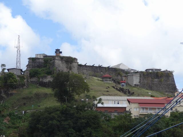
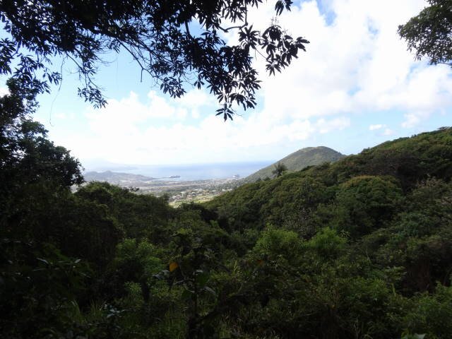
The final stop was Fort Frederick high above near St. George's. There is
also another one, Fort Matthew, next to Fort Frederick. The forts are
practically ruins with no armament. We had great views of the capital.
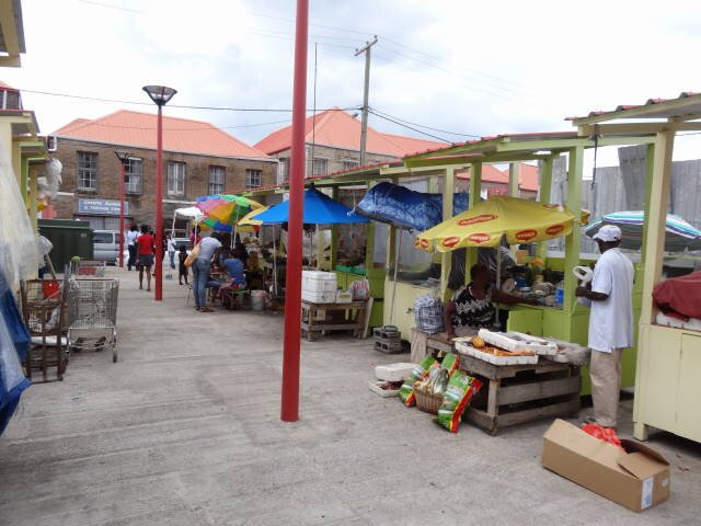
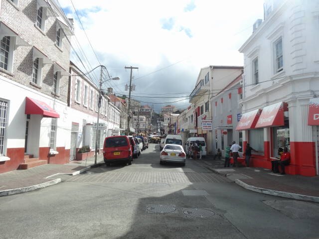
We then walked around the city and visited the Open Market where fruits
and vegetables are sold. There really is not much to do in St. George's.
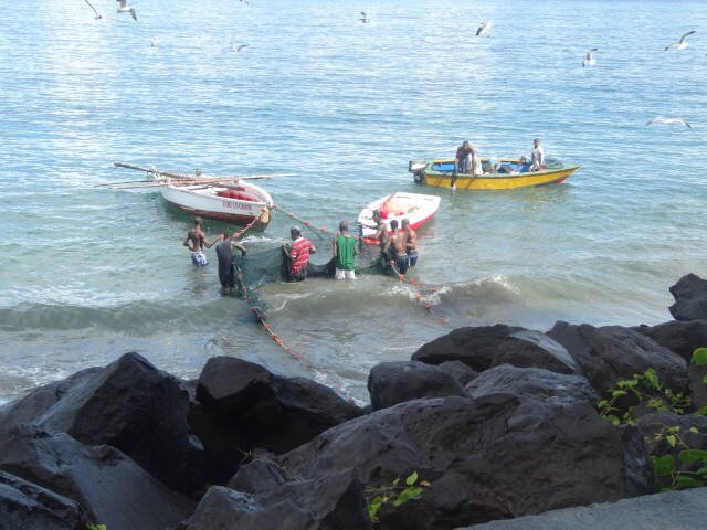
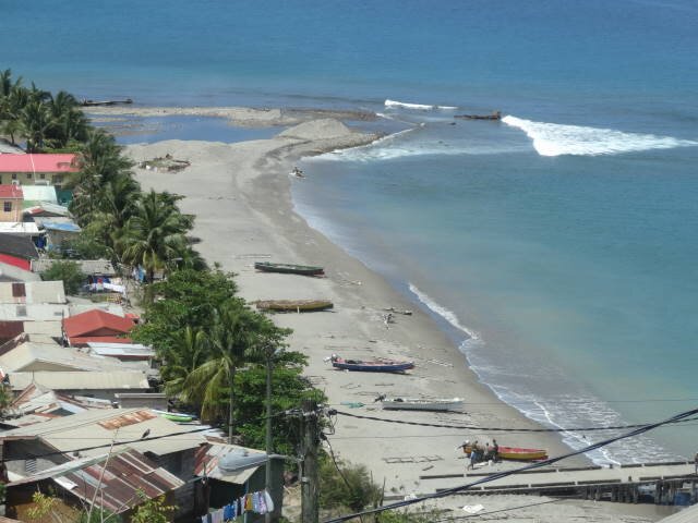
Seine fishing near Gouyave
Douglaston Plantation -- sun drying spices
Douglaston Plantation sales shed
Douglaston Plantation - Cacao pod and beams -- Outside of sales shed
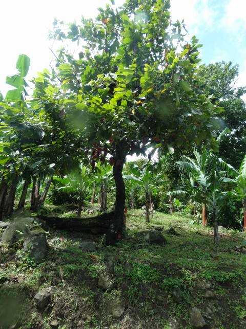
Bananas wrapped in blue plastic -- Cacao tree -- Nutmeg tree
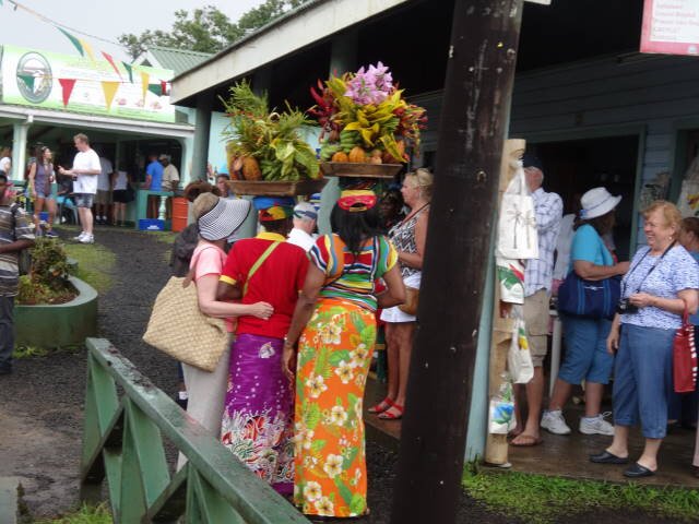
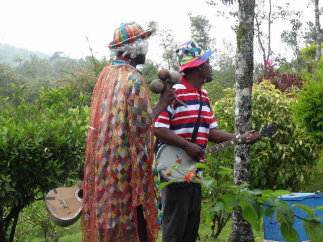
Grand Etang Park - Pineapple women -- Local musicians
Grand Etang Park
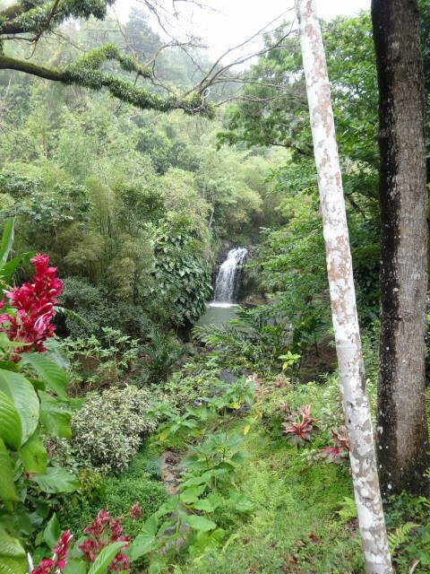
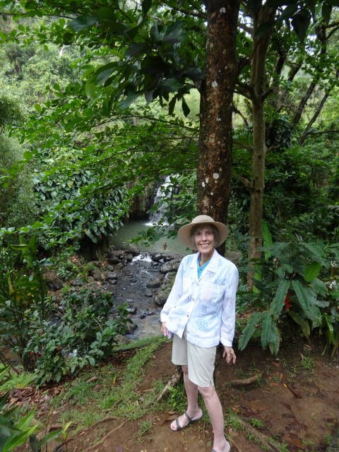
Annandale Falls
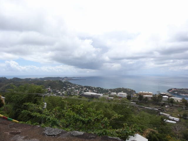
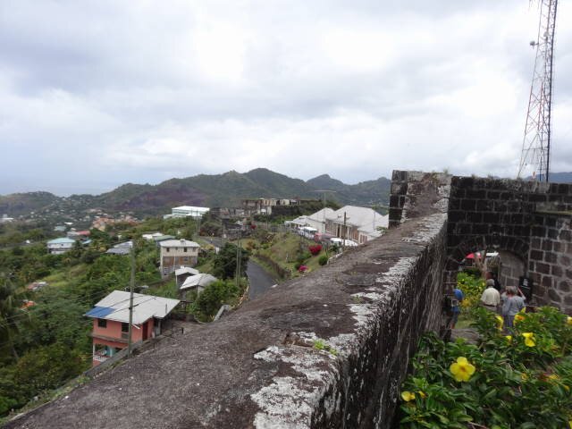
View from Fort Frederick -- Fort Matthew from Fort Frederick
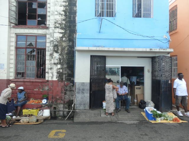
Fort George --- Open Market
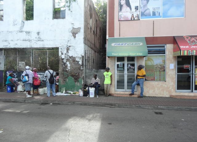
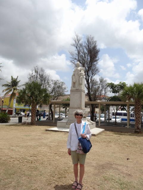
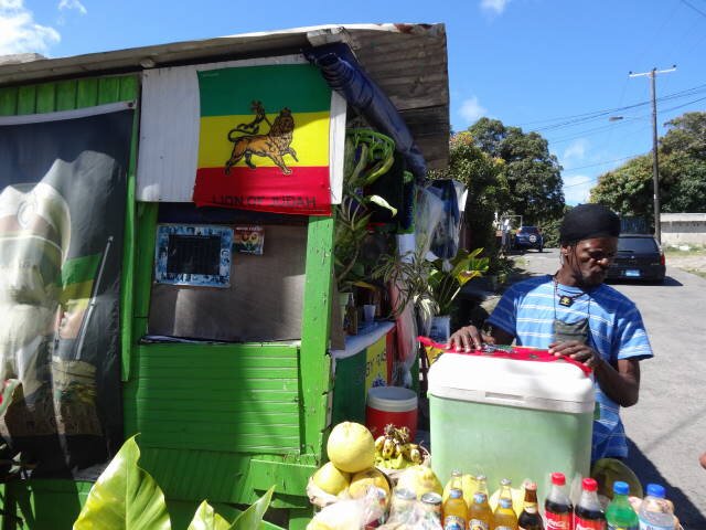
St. George
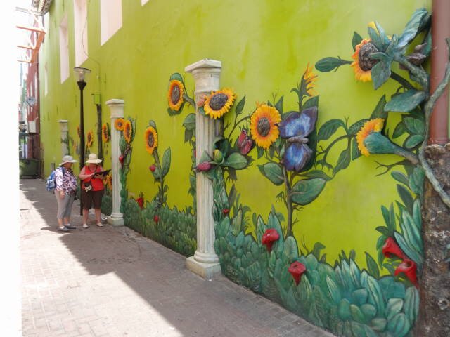
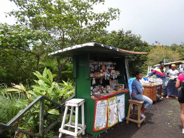
St. George street sellers
BARBADOS
Bridgetown, Barbados
BACKGROUND:
Barbados is a sovereign island country in the Lesser Antilles. It is 34 kilometres (21 mi) in length and up to 23 kilometres (14 mi) in width, covering an area of 432 km2 (167 sq mi). It is situated in the western area of the North Atlantic and 100 kilometres (62 mi) east of the Windward Islands and the Caribbean Sea; therein, it is about 168 kilometres (104 mi) east of the islands of Saint Vincent and the Grenadines and 400 kilometres (250 mi) north-east of Trinidad and Tobago.
Amerindian settlement of Barbados dates to about the 4th to 7th centuries AD, by a group known as the Saladoid-Barrancoid. In the 13th century, the Kalinago arrived from South America.
Barbados was visited by Spanish navigators in the late 15th century and claimed for the Spanish Crown. It first appears on a Spanish map from 1511. The Portuguese visited the island in 1536, but they left it unclaimed, with their only remnants being an introduction of wild hogs for a good supply of meat whenever the island was visited. The Arawaks are believed to have fled to neighbouring islands. Apart from possibly displacing the Caribs, the Spanish and Portuguese left little impact and left the island uninhabited. Some Arawaks migrated from British Guiana (modern day Guyana) in the 1800s and continue to live in Barbados.
The first English ship, the Olive Blossom, arrived in Barbados in 1625. They took possession of it in the name of King James I. In 1627 the first permanent settlers arrived from England, and it became an English and later British colony. From the arrival of the first English settlers in 1627–1628 until independence in 1966, Barbados was under uninterrupted English and later British governance and was the only Caribbean island that did not change hands during the colonial period. In the very early years, the majority of the population was white and male, with African slaves providing little of the workforce. Cultivation of tobacco, cotton, ginger and indigo was handled primarily by European indentured labour until the start of the sugar cane industry in the 1640s. As Barbados' economy grew, Barbados developed a large measure of local autonomy through its founding as a proprietary colony. Its House of Assembly began meeting in 1639.
In 1966, Barbados became an independent state and Commonwealth realm, retaining Queen Elizabeth II as Head of State. It has a population of 277,821 people, mostly of African descent.
OUR VISIT:
We joined one of the ship-sponsored tours, Coast to Coast. The guide
Maggie was excellent. She was not a native Barbadoan, her mother was French and
she had a trace of a French accent. She asked that while she was speaking that
others refrain from conversation so others can hear her. Later, some folks were
talking amongst themselves and she stood up and basically said that she asked
that folks refrain from loud talk, if they persisted, she would not speak and
folks could look out the windows to figure out what was going on. Conversation
stopped! Good for her!
Barbados was originally discovered by Portuguese mariners. The island at
that time was covered by a type of tree that has hanging roots so they named it
Barbadus, the wild bearded one. The English actually arrived later in 1627 and
claimed the island. They established the Anglican religion and forbade Catholic
priests from coming to the island under the guise that they would favor the
French. Barbados remained under British rule and did not experience the regime
changes that the Windward Islands experienced. The official language is English
though the blacks speak a patois dialect which she described as developed by the
slaves so the masters could not understand what they were saying.
The actual head of government is the Prime Minister who is elected from
one of two parties for five years. The British ruler is the Head of State and
he/she appoints the Governor General.
The island is very flat and is coral. It is not part of the Windward or
Leeward Islands, it is east of them and is completely surrounded by the Atlantic
Ocean. It is very lush and green. The soil is very fertile with many crops grown
here, bananas, plantains, papaya, breadfruit (from Tahiti), and sugar cane. The
poor can live off the fruit from the trees. There is an elevated area called The
Highlands where the highest point is about 1200 ft. ASL. This was the area where
the white colonialists preferred to live.
It is laid out in 11 parishes. When the Brits colonized the island, they
established 11 churches, their parish is named after the particular saint that
the church was named for.
There are luxurious hotels here that tourists patronize. One, "Sandy
L", charges US$1500 a night for a room! Many foreigners own nice homes here
that they stay in during the winter. Many homes are unpainted. This, until
recently, exempted them from taxation! The government t bureaucrats/taxers fixed
this situation, to the dismay of these property owners.
Barbados raises many products and the largest export item is sugar from
cane. Unlike the Windward Islands, cane is harvested by machine instead of men
with machetes because of the flatness of the land. She said the government is
going to stop raising sugar cane because the "health" community says
sugar is bad for people. Apparently the "political correct" insanity
even prevails in Barbados! Talk about cutting off your nose to spite your face!
What nonsense governments buy into and force on their citizens.
We drove up the west coast. It has numerous beautiful beaches, most with
white sand but some with black sand. The surf is very easy here and people swim
on the west coast. We turned off at a place called Holetown to transit across
the island.
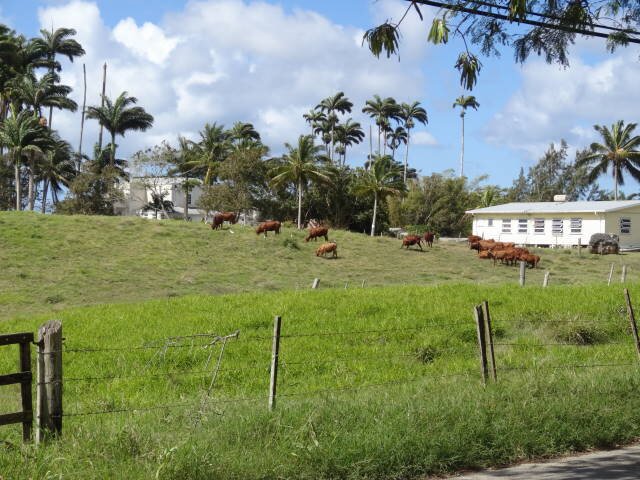
We stopped at a place in the hills, Highlands. There we were treated to a
complimentary rum punch or beer. You could see the sea all around the island. It
was a beautiful and peaceful sight. There was a farm across the road where
cattle were grazing.
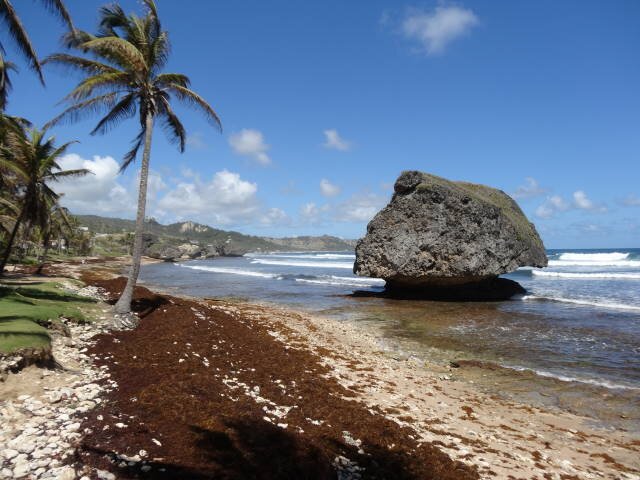
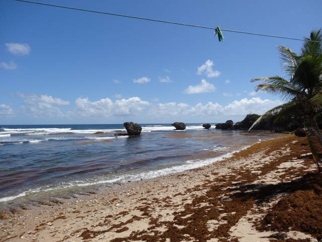
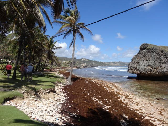
On the east coast, the surf is much heavier and the sea is plagued with
sargasso which Maggie said was from Australia! The east coast is not developed
and the few beaches have pink sand, We stopped at one in Bathsheba named
Barclay Park after the company that paid for its amenities.
We then drove to St. John's Parish Church where a Mass was underway. This
is a beautiful Anglican church that was originally built in 1645. It was
destroyed by a hurricane and was rebuilt in 1836. The graveyard contains the
remains of a Greek descendent of Constantine who was buried here in 1678.
There is a ridge just to the west that the Brits felt was a natural
barrier to dissuade other powers from trying to occupy Barbados, so
they did not build defensive positions on that side of the island.
The island is undoubtedly the best one we have visited so far. It is clean
and I guess relatively safe. The ship though did warn us to not wear jewelry,
watch our cameras protectively, and be alert for pickpockets. The capital
Bridgetown was much larger and better organized that the other islands. Being
Sunday, there was not much activity in town.
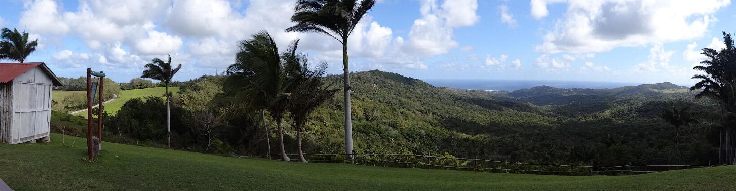
Panorama from the Highlands
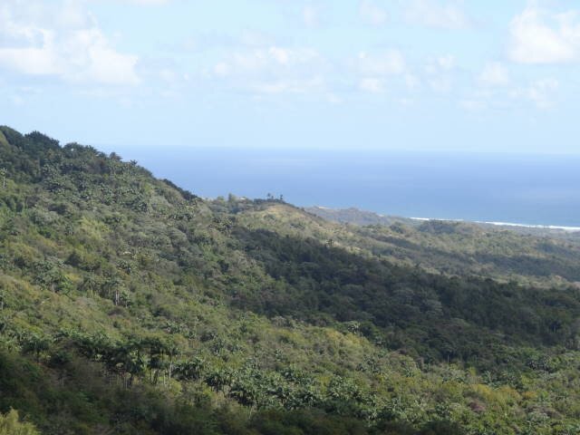
The Highlands
The Highlands
Bathsheba
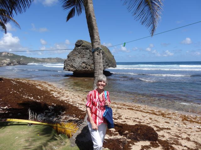
Bathsheba Rock
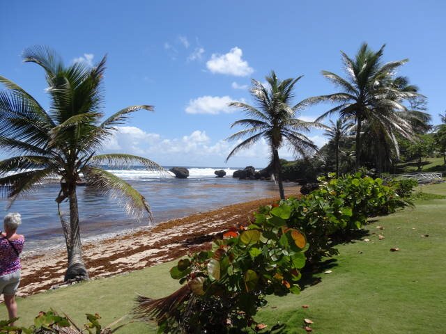
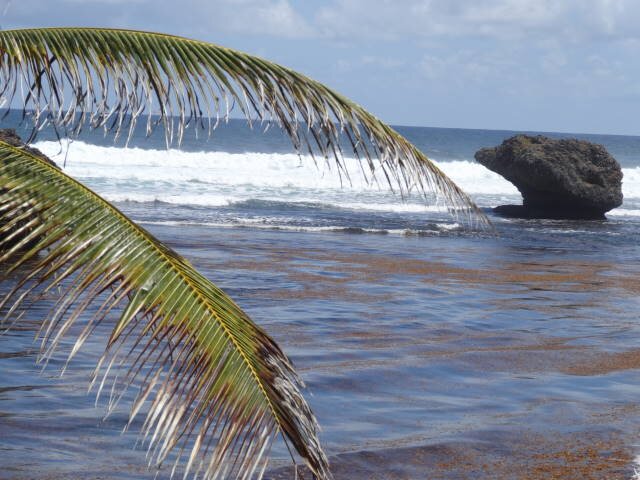
Bathsheba
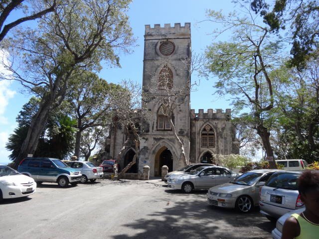
St. John's Parish Church
St. John's Parish Church
ST. LUCIA
Castries, St. Lucia
BACKGROUND:
Saint Lucia is a sovereign island country in the eastern Caribbean Sea on the boundary with the Atlantic Ocean. Part of the Lesser Antilles, it is located north/northeast of the island of Saint Vincent, northwest of Barbados and south of Martinique. It covers a land area of 617 km2 (238.23 sq mi) and has a population of 174,000 (2010). Its capital is Castries.
One of the Windward Islands, Saint Lucia was named after Saint Lucy of Syracuse by the French, the island's first European settlers. They signed a treaty with the native Carib Indians in 1660. England took control of the island from 1663 to 1667; in ensuing years, it was at war with France 14 times; and rule of the island changed frequently (it was seven times each ruled by the French and British). In 1814, the British took definitive control of the island. Because it switched so often between British and French control, Saint Lucia was also known as the "Helen of the West Indies".
Representative government came about in 1840 (with universal suffrage from 1953). From 1958 to 1962, the island was a member of the Federation of the West Indies. On 22 February 1979, Saint Lucia became an independent state of the Commonwealth of Nations associated with the United Kingdom. Saint Lucia is a mixed jurisdiction meaning that it has a legal system based in part on both the Civil Law and English common law. The Civil Code of St. Lucia of 1867 was based on the Quebec Civil Code of 1866, as supplemented by English common law-style legislation. It is also a member of la Francophonie.
OUR VISIT:
Again we took a ship's tour, Soufrière Volcano.
Our guide was a fellow named Mark who wore a 101th Airborne Vietnam ball cap and
said he served in that unit for 16 years in England, Germany, and Vietnam. He
was a native St. Lucian peaking with a bit of a French accent. He was apparently
very knowledgeable about St. Lucia and extremely supportive of it. He spoke too
fast and almost shouted into the PA system so it was hard to understand him much
of the time.
St. Lucia experienced many battles between the French and the British in
the 18th Century, changing regimes 14 times, 7 times French, 7 times British.
The Brits wanted St. Lucia as a coaling station (they had one in Jamaica and
needed one in the Antilles to support their ventures in South America. The
island's towns mostly bear French names. The people are Catholic (the largest
building in every town/village is the local Catholic Church). Their law is built
on the British model. They elect their Prime Minister for five year terms and
the Queen's representative is the Governor General.
All property is privately owned. Land prices are reasonable but you cannot
resell the property unless you make an improvement (even a shack qualifies). The
homes run from real run-down shacks to beautiful mansions. Most people are of
African descent though there are areas where they are mixed French-Arawak
families (he told us the Brits forbade French from owning property so many
married the indigenous Indian people (some even married former slaves). The
property was owned by the wife, not the Frenchman.
The island is green and lush and very mountainous in the northern parts.
They get 160 inches of rain per year. The island, like all the Antilles, was
formed by volcanic action. The caldera of the now-dormant volcano is located at
the town of Soufrière.
Mark bragged about all the "free" benefits for St. Lucians,
apparently ignorant of the fact that somebody is paying for these services.
The island is very fertile and anything that can grow in a wet climate
from 60º to 100º F grows here. They are almost totally self-supporting and
they export many items, particularly to the UK, even water from their springs!
We drove down the west coast road heading to La Soufriere
volcano. We passed an 17th century French ammunition bunker in Charlotte.
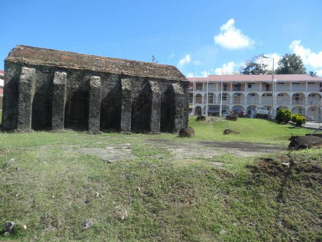
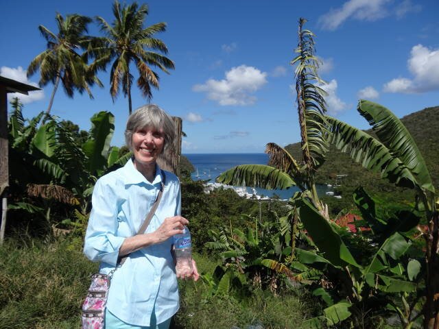
The first stop was overlooking Marigot Bay at a vendors'
plaza. There were several stands selling souvenirs and local sauces.
Marilyn bought a bottle of banana ketchup. There were also free lancers selling
woven baskets. One approached us and I said we weren't interested. He cursed us
as "cheap ***s."
Next was the fishing town of Canaries. From there we
proceeded to the Marantha Gardens, a botanical area near Palmiste. We walked
through observing indigenous plants, flowers, and trees.
From there we proceeded to La Soufrière Volocano. The
sulfur springs which inspired the French name Soufrière are referred to as
“the world’s only drive-in volcano.” What this actually means in practical
terms is that you can drive up to the dormant Qualibou volcano and visit
springs, which still issue steam and other signs of geothermal life. Napoleon's
wife the Empress Josephine lived in Soufrière as a child.
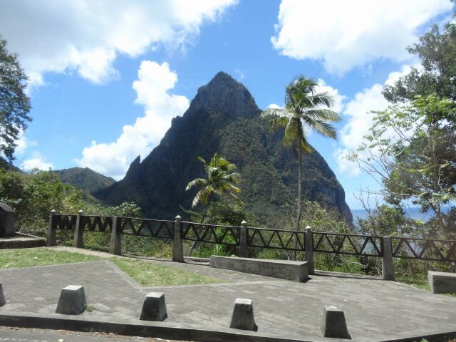
The Pitons are also seen from the area. These
are very steep hills that are essentially plugs that grew from volcanic
tributaries that did not erupt violently but expelled rock that solidified into
these peaks.
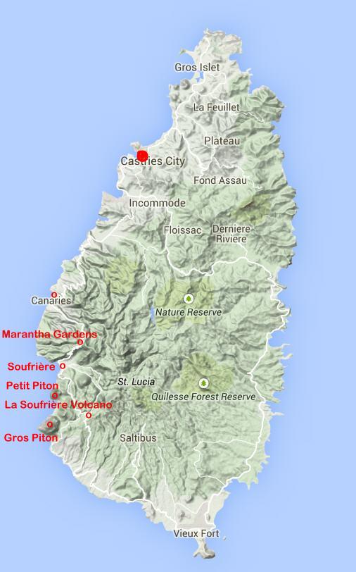
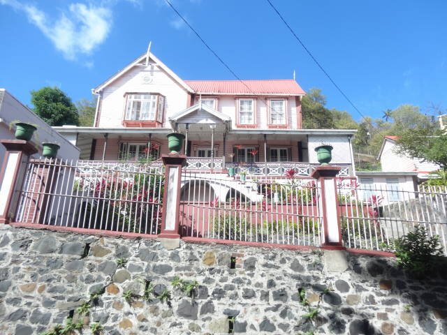
Castries home -- Old French ammunition bunker
Vendor Plaza at Marigot Bay
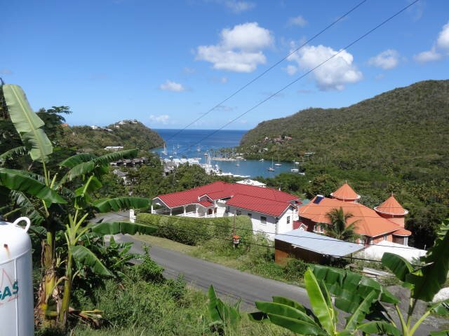
Marigot Bay
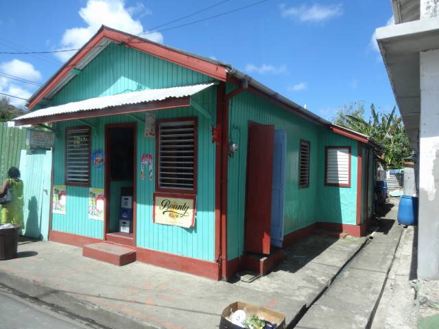
Bar -- Old house
Canaries

Marantha Gardens
Piton -- Sulfur Springs Park
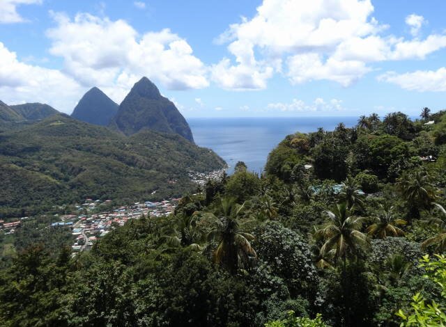
With guide Mark -- Pitons
ANTIGUA
BACKGROUND:
Antigua is an island in the West Indies, in the Leeward Islands in the Caribbean region, the main island of the country of Antigua and Barbuda. Antigua means "ancient" in Spanish after an icon in Seville Cathedral, Santa Maria de la Antigua—St. Mary of the Old Cathedral. The island's circumference is roughly 87 km (54 mi) and its area 281 km2 (108 sq mi). Its population was 80,161 (at the 2011 Census). The economy is mainly reliant on tourism, with the agricultural sector serving the domestic market.
Over 31,000 people live in the capital city, St. John's. The capital is situated in the north-west and has a deep harbour which is able to accommodate large cruise ships. Other leading population settlements are All Saints (3,412) and Liberta (2,239), according to the 2001 census.
English Harbour on the south-eastern coast is famed for its protected shelter during violent storms. It is the site of a restored British colonial naval station called "Nelson's Dockyard" after Captain Horatio Nelson. Today English Harbour and the neighbouring village of Falmouth are internationally famous as a yachting and sailing destination and provisioning center.
Prior to European colonialism, the first residents were the Ciboney people. Eventually, the Arawak migrated from the mainland, followed by the Carib. Christopher Columbus was the first European to visit Antigua, in 1493. The Arawak were the first well-documented group of indigenous people to settle Antigua. They paddled to the island by canoe (piragua) from present-day Venezuela, pushed out by the Carib, another indigenous people. The Arawak introduced agriculture to Antigua and Barbuda. Among other crops, they cultivated the now noted Antiguan "Black" pineapple.
Most of the Arawak left Antigua about A.D. 1100. Those who remained were raided by the Carib coming from Venezuela. According to The Catholic Encyclopedia[full citation needed], the Caribs' superior weapons and seafaring prowess allowed them to defeat most Arawak nations in the West Indies. They enslaved some and cannibalised others. The Catholic Encyclopedia[full citation needed] does note that the European invaders had difficulty identifying and differentiating between the various native peoples they encountered. As a result, the number and types of ethnic/tribal/national groups at the time were likely more varied and numerous than the two mentioned in this article.
The indigenous people of the West Indies made excellent sea vessels, which they used to sail the Atlantic and Caribbean. As a result, the Arawak and Carib populated much of the South American and the Caribbean islands. Their descendants live throughout South America, particularly Brazil, Venezuela and Colombia. The native-identified populations in the West Indies maintain a pride in their heritage.
Christopher Columbus named the island "Antigua" in 1493 in honour of the "Virgin of the Old Cathedral" (Spanish: La Virgen de la Antigua) found in Seville Cathedral in southern Spain. On his 1493 voyage, honouring a vow, he named many islands after different aspects of St. Mary, including Montserrat and Guadaloupe.
In 1632, a group of English colonists left St. Kitts to settle on Antigua. Sir Christopher Codrington, an Englishman, established the first permanent European settlement. From that point on, Antigua history took a dramatic turn. Codrington guided development on the island as a profitable sugar colony. For a large portion of Antigua history, the island was considered Britain's "Gateway to the Caribbean". It was located on the major sailing routes among the region's resource-rich colonies. Lord Horatio Nelson, a major figure in Antigua history, arrived in the late 18th century to preserve the island's commercial shipping prowess.
In 1968, with Barbuda and the tiny island of Redonda as dependencies, Antigua became an associated state of the Commonwealth, and in 1981 it was disassociated from Britain. The country was then led by what many describe as an elected family dynasty, with Vere C. Bird, the first prime minister, having been succeeded in 1993 by Lester B. Bird, his son, who retained the post until 2004. Since March 2004 to June 12, 2014 Baldwin Spencer led the country. General elections were held and the leader of the opposition Hon. Gaston Browne's Antigua and Barbuda Labour Party won 14 of the 17 parliamentary seats.
OUR VISIT:
We took a ship's Safari 4x4 off-road tour for a land tour. The driver was
an older fellow named Foster. The PA system on the Jeep was very bassy and
muffled so we did not understand much of what he was saying. Fortunately for us,
the jeep had a sun shade to protect us from the direct sun.
The tour name "off-road" was a bit of a misnomer. We only were
on one unpaved dirt road for about a mile. All the rest of the tour was on
paved roads.
The weather was hot! The sun was brutal and here was not much air
movement.
Most homes are built on pylons. This is done to allow the owners to
complete the lower story for a family residence or for rent sometime in the
future.
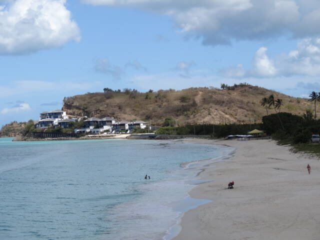
We went by many pretty beaches and a few nice resorts. While at Carlisle
Bay we were able to see Montserrat and Guadeloupe islands. Foster served us rum
punch at this stop.
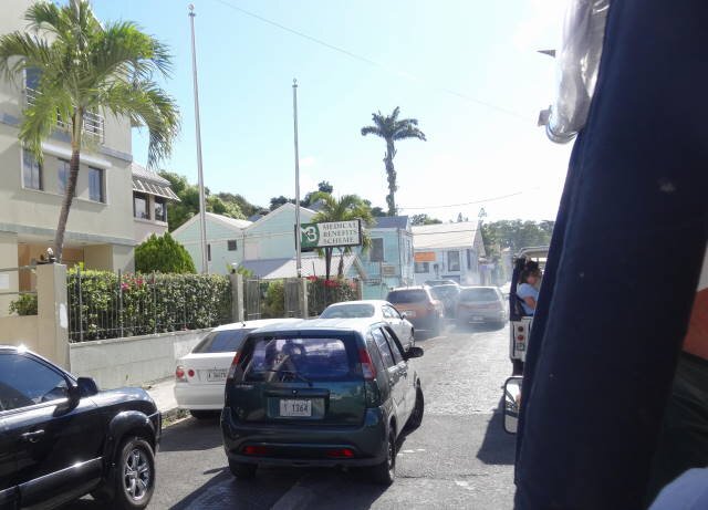
The tour encompassed most of the island. The island is not well kept up.
The capital main street had nothing but jewelry shops and run down shops. As we
proceeded back to the boat we saw a sign for Napoleon's Bar. We followed it and
was on another street of modern shops and restaurants. We would not care to
visit here again!
Our 4X4 vehicle
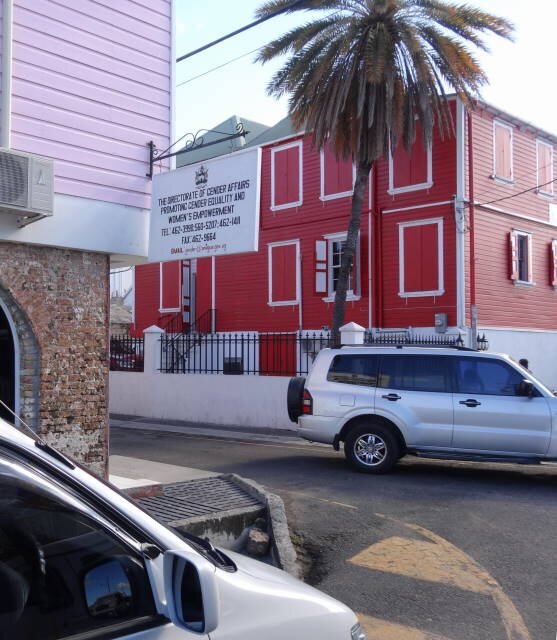
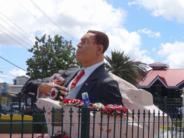
"Poltical Correctness" in St. Georges - Directorate of Gender Affairs Promoting Gender Equality -- Medical Benefits Scheme (must be their version of "Obamacare", at least they recognize it's a scheme)!
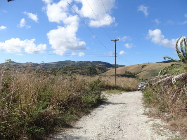
The off-road segment
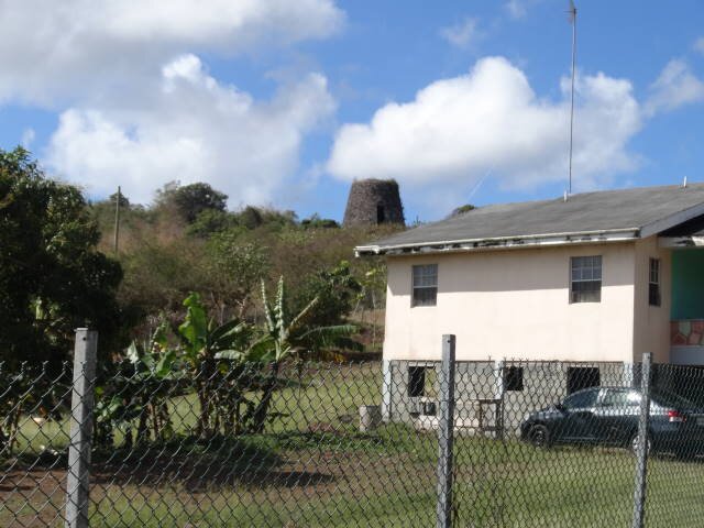
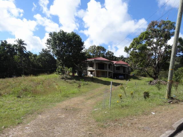
Home with old stone sugarmill on the hill -- nicer home
Church destroyed by hurricane -- Carlisle Bay
Homes near Cades Bay -- Darkwood Beach
St. Johns - Statue of 1st PM Vere Cornwall Bird - Street scene
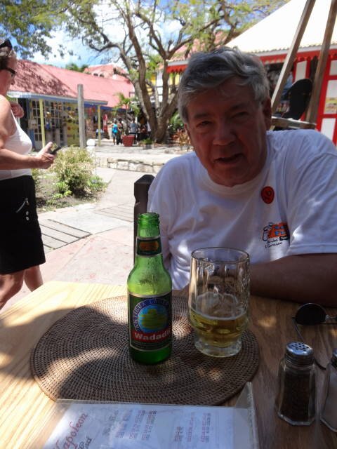
Cool ones at Napoleon's Restaurant
St. Johns waterfront
ST. KITTS
BACKGROUND:
Saint Kitts (also known more formally as Saint Christopher Island) is an island in the West Indies. The west side of the island borders the Caribbean Sea, and the eastern coast faces the Atlantic Ocean. Saint Kitts and the neighbouring island of Nevis constitute one country: the Federation of Saint Kitts and Nevis.
The island is one of the Leeward Islands in the Lesser Antilles. It is situated about 2,100 km (1,300 mi) southeast of Miami, Florida. The land area of St. Kitts is about 168 km2 (65 sq mi), being approximately 29 km (18 mi) long and on average about 8 km (5.0 mi) across.
Saint Kitts has a population of around 45,000, the majority of whom are mainly of African descent. The primary language is English, with a literacy rate of approximately 98%.
Brimstone Hill Fortress National Park, a UNESCO World Heritage Site, is the largest fortress ever built in the Eastern Caribbean.
During the last Ice Age, the sea level was 200 feet (61 m) lower and St. Kitts and Nevis were one island along with Sint Eustatius (also known as Statia).
St. Kitts was originally settled by pre-agricultural, pre-ceramic "Archaic people", who migrated south down the archipelago from Florida. In a few hundred years they disappeared, to be replaced by the ceramic-using and agriculturalist Saladoid people around 100 BC, who migrated to St. Kitts north up the archipelago from the banks of the Orinoco River in Venezuela. Around 800 AD, they were replaced by the Igneri people, members of the Arawak group.
Around 1300, the Kalinago, or Carib people arrived on the islands. These war-like people quickly dispersed the Igneri, and forced them northwards to the Greater Antilles. They named Saint Kitts "Liamuiga" meaning "fertile island", and would likely have expanded further north if not for the arrival of Europeans.
A Spanish expedition under Christopher Columbus discovered and claimed the island for Spain in 1493. A short-lived French Huguenot settlement was established at Dieppe Bay in 1538.
The first English colony was established in 1623, followed by a French colony in 1625. The English and French briefly united to massacre the local Kalinago (preempting a Kalinago plan to massacre the Europeans), and then partitioned the island, with the English colonists in the middle and the French on either end. In 1629, a Spanish force sent to clear the islands of foreign settlement seized St. Kitts. The English settlement was rebuilt following the 1630 peace between England and Spain.
The island alternated repeatedly between English (then British) and French control during the 17th and 18th centuries, as one power took the whole island, only to have it switch hands due to treaties or military action. Parts of the island were heavily fortified, as exemplified by the UNESCO World Heritage Site at Brimstone Hill and the now-crumbling Fort Charles.
Since 1783, St. Kitts has been affiliated with the United Kingdom.
OUR VISIT:
We went with another ship's tour, again 4x4 land safari tour put on by Greg's. The driver was Anil, a very knowledgeable and friendly young man. The Jeep was much newer that the one on Antigua and the PA system worked fine.
There had just been an election so the island was inundated with political posters.
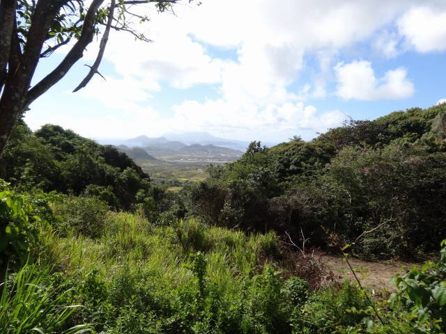
We drove through the rain forest which was very dense. We stopped at a home on one of the highland areas of the island where Anil took us around the property and set up a juice bar for us, with rum punch if we wanted it. There was a panorama of the beautiful island from the site.
He told us that they only raise 1% of their foodstuffs, 99% is imported. There we asked questions about the country. One fellow asked about corruption in the government. He replied that there was indeed. He stated that usually for the first two years, the politicians are good but after then they figure out where the money is and change to maximize their financial situation. Much like the United States, I commented. He was asked about taxes and he said they have a 17% VAT that applies to everything, including food. He also said they have income and other taxes. He stated that his shirt probably retailed for $25 (they use the East Caribbean dollar which is worth about US $0.30). He said after import tax, VAT, and other miscellaneous taxes, the shirt will actually sell for $60!
We then proceeded down the southeast coast to Friar's Bay Beach at a hotel where we had a little over an hour stop. Most of the folks did the water thing. It was a very pretty locale but we pretty much kept out of the sun, though Marilyn did dip her feet into the ocean.
The island is very clean, most roads are good. They are transitioning from a sugar-based economy to a tourist-based one. There are a few new hotels and condos on the Atlantic side. The weather was much better than Antigua, the sun wasn't as brutal and there was a fair breeze most of the trip, overall enjoyable weather.
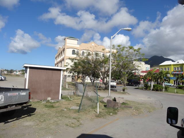
Base Terre street scene -- Street sellers

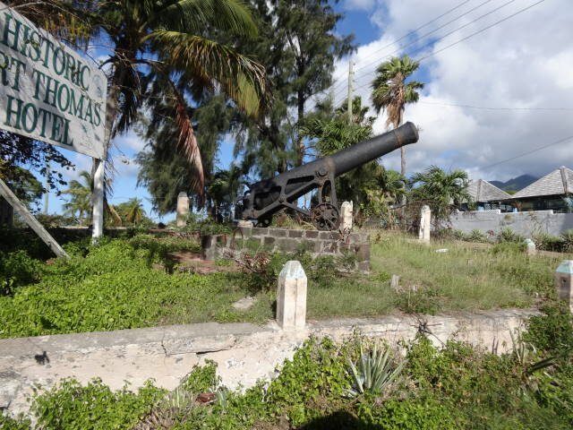
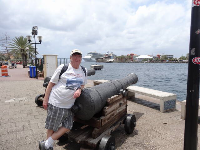
Fisherman cleaning fish -- Old cannon
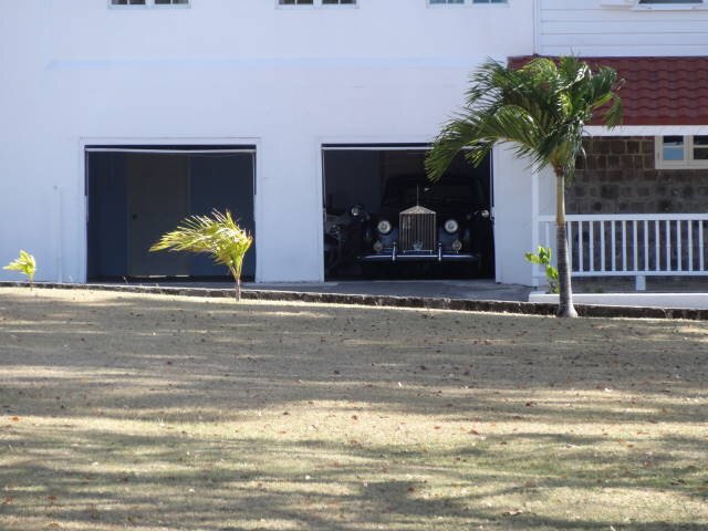
Governor General's house and his Rolls Royce
Homes
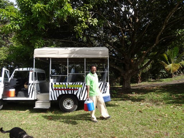
Highlands - Anil with our 4X4 -- View to the northwest
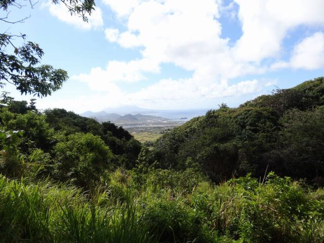
Highlands - View to the southeast -- View to the south-southeast
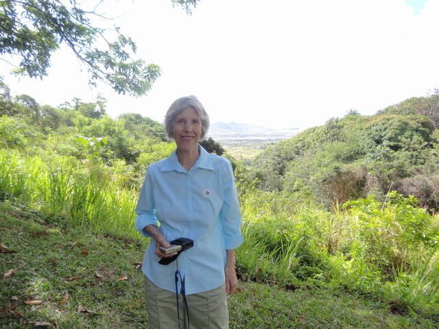
Highlands - Marilyn -- View to the south
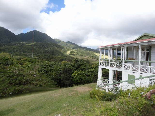
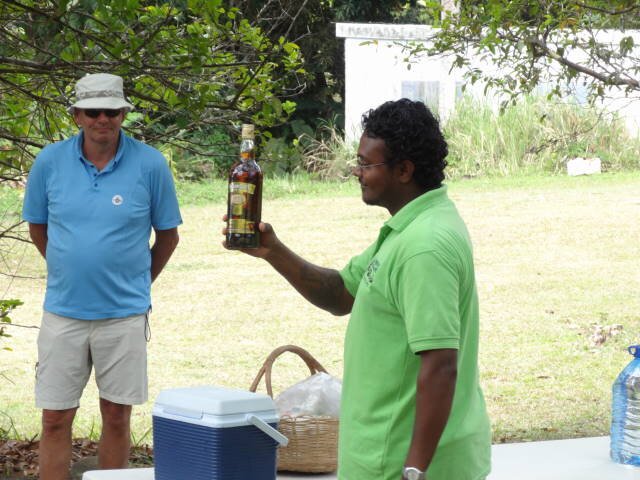
Highlands - Home -- Anil and his rum
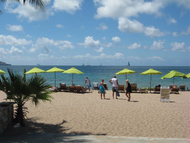
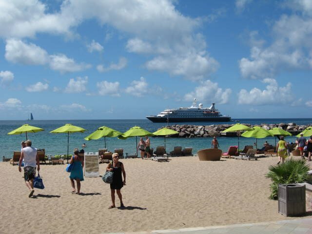
Friar's Bay Beach - With SeaDream Yacht Club ship
SINT MARTEEN / ST. MARTIN
BACKGROUND:
In 1493, during Christopher Columbus' second voyage to the West Indies, upon first sighting the island he named it Isla de San Martín after Saint Martin of Tours because it was 11 November, St. Martin's Day. However, though he claimed it as a Spanish territory, Columbus never landed there, and Spain made the settlement of the island a low priority.
The French and Dutch, on the other hand, both coveted the island. While the French wanted to colonize the islands between Trinidad and Bermuda, the Dutch found San Martín a convenient halfway point between their colonies in New Amsterdam (present day New York) and Brazil. With few people inhabiting the island, the Dutch easily founded a settlement there in 1631, erecting Fort Amsterdam as protection from invaders. Jan Claeszen Van Campen became its first governor, and soon thereafter the Dutch East India Company began their salt mining operations. French and British settlements sprang up on the island as well. Taking note of these successful colonies and wanting to maintain their control of the salt trade, the Spanish now found St. Martin much more appealing. The Eighty Years' War which had been raging between Spain and the Netherlands provided further incentive to attack.
Spanish forces captured Saint Martin from the Dutch in 1633, seizing control and driving most or all of the colonists off the island. At Point Blanche, they built what is now Old Spanish Fort to secure the territory. Although the Dutch retaliated in several attempts to win back St. Martin, they failed. Fifteen years after the Spanish conquered the island, the Eighty Years' War ended. Since they no longer needed a base in the Caribbean and St. Martin barely turned a profit, the Spanish lost their inclination to continue defending it. In 1648, they deserted the island.
With St. Martin free again, both the Dutch and the French jumped at the chance to re-establish their settlements. Dutch colonists came from St. Eustatius, while the French came from St. Kitts. After some initial conflict, both sides realized that neither would yield easily. Preferring to avoid an all-out war, they signed the Treaty of Concordia in 1648, which divided the island in two. During the treaty's negotiation, the French had a fleet of naval ships off shore, which they used as a threat to bargain more land for themselves. In spite of the treaty, relations between the two sides were not always cordial. Between 1648 and 1816, conflicts changed the border sixteen times. In the end, the French came out ahead with 21 square miles (54 km2) to the 16 square miles (41 km2) of the Dutch side.
With the new cultivation of cotton, tobacco, and sugar, the French and the Dutch imported a massive number of slaves to work on the plantations. The slave population quickly grew larger than that of the land owners. Subjected to cruel treatment, slaves staged rebellions, and their overwhelming numbers made them impossible to ignore. On 12 July 1848, the French abolished slavery on their side of St. Martin. The Dutch followed suit fifteen years later.
OUR VISIT:
We bought a tour from Bernard's Tours. It was Tour 2, a 6 hour tour by bus
on the island. The driver/guide was DJ, a native St. Kittsean who has lived in
St. Maarten for 15 years. He was very knowledgeable.
He had an on-board bar with rum punch, beer, sodas, and bottled water on
ice! The drinks were complimentary. He told us at the start that a glass of rum
punch is an "eye-opener." Interestingly, Dutch St. Maarten has no
speed limit. French St. Martin does. He told of an experience in the French area
when he was pulled over by the local gendarmes for driving too slow and impeding
traffic. He was taken to the gendarmerie where he was fined €600 (at the time
about US$1000). The island has over 40 inches of rain a year.
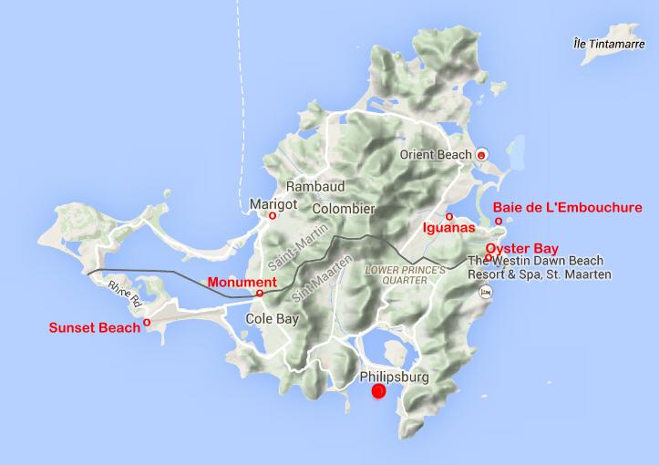
SINT MARTEEN
BACKGROUND:
Sint Maarten is a constituent country of the Kingdom of the Netherlands. It encompasses the southern third of the Caribbean island of Saint Martin, while the northern two-thirds of the island constitutes the French overseas collectivity of Saint-Martin. Its capital is Philipsburg. Its population is 37,000 on 34km2.
Before 10 October 2010, Sint Maarten was known as the Island Territory of Sint Maarten and was one of five island territories that constituted the Netherlands Antilles.
Sint Maarten became an "island territory" of the Netherlands Antilles in 1983. Before that date, Sint Maarten was part of the island territory of the Windward Islands, together with Saba and Sint Eustatius. The status of an island territory entails considerable autonomy summed up in the Island Regulation of the Netherlands Antilles. The island territory of Sint Maarten was ruled by an island council, an executive council, and an administrator appointed by the Dutch Crown. On 10 October 2010, Sint Maarten became a constituent country within the Kingdom of the Netherlands, making it a constitutional equal partner with Aruba, Curaçao, and the Netherlands proper.
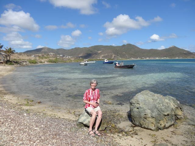
OUR VISIT:
We tied up at the pier in Philipsburg at 0800. We left he ship to walk to
the welcome station to meet up with the tour company. Our bus carried 26 people
and the driver/guide. We drove over to the Atlantic coast and then up the
island. Within a short time, we came to the border and passed into French St.
Martin.
The island imports 95% of its foodstuffs. There are no rivers on the
island so the water is furnished from a desalinization plant. Many rich and
famous own mansions on the island and their yachts are often seen in the ports.
After our visit to French St. Martin, we drove to the border crossed
marked with a monument celebrating 300 years of the Concordant that divided the
island (1648-1948). Flags of France, Netherlands, Sint Maarten and the European
Union were flying.
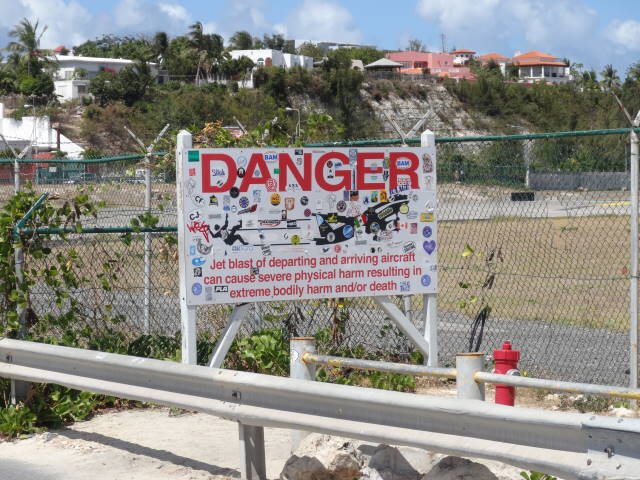
We then traveled down to Maho Beach which is directly in front of the
approach path for aircraft landing at the International Airport. Crowds were
there watching for the incoming planes that are only a few hundred feet above
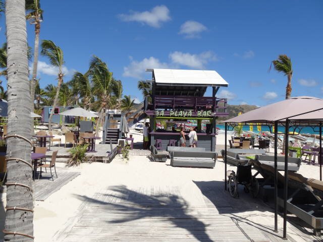
the beach on their landing approach. There is a bar there called Sunset where if
a group comes in and at last one is a topless female, the bar provides
gratis drinks to the party!
After that we drove through the Simpson Bay Marina on one of the two
bridges on the island. Many rich and famous own mansions on the
island and their yachts are often seen in the ports. After that we headed up to
Harold Jack Hill to view the area and the nearby British island of Anguilla.
Then we returned to Philipsburg but did not have time to wander around the
capital of Dutch Sint Maarten (plus we were beat down from the hot weather).
The tour was well worth the $45 per person charge considering all we saw,
the free drinks on the bus, and the information provided by DJ, the
driver/guide.
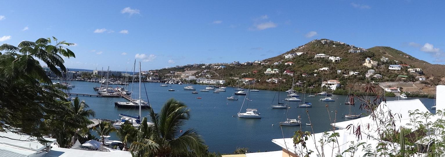
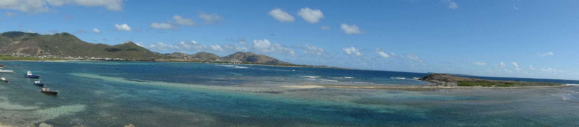
Oyster Bay from the French side looking to the Dutch Side
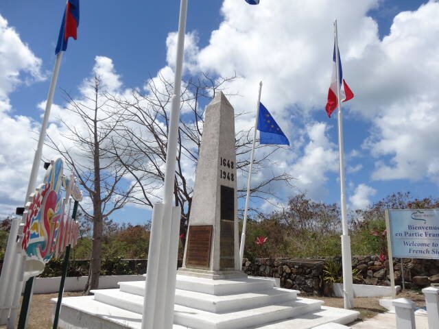
Monument to Concordant of 1648 -- Airport
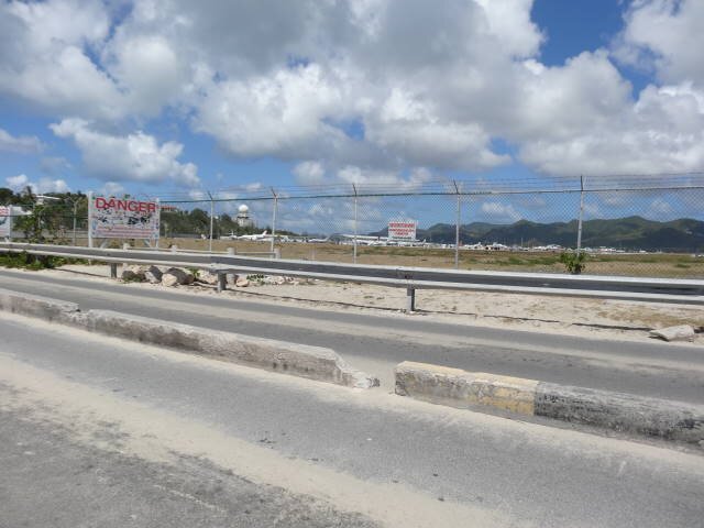
Princess Juliana Airport where aircraft land just above Sunset Beach
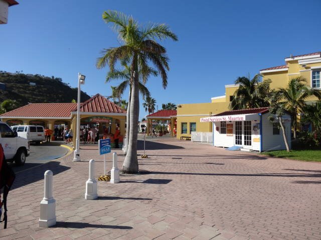
Philipsburg
ST. MARTIN
BACKGROUND:
Saint Martin, officially the Collectivity of Saint Martin is an overseas collectivity of France located in the Caribbean. It came into being on 15 July 2007, encompassing the northern two-thirds of Saint Martin island and neighbouring islets, the largest of which is Île Tintamarre. A Collectivity is a French term denoting a poolitical subdusion that has some degree of autonomy. Its capital is Marigot. It has a population of 36,286 (as of Jan. 2011).
Saint Martin was for many years a French commune, forming part of Guadeloupe, which is an overseas région and département of France and is therefore in the European Union. In 2003 the population of the French part of the island voted in favour of secession from Guadeloupe in order to form a separate overseas collectivity (COM) of France. On 9 February 2007, the French Parliament passed a bill granting COM status to both the French part of Saint Martin and (separately) the neighbouring Saint Barthélemy. The new status took effect once the local assembly was elected on 15 February 2007. Saint Martin remains part of the European Union.
The new governance structure befitting an overseas collectivity took effect on 15 July 2007 with the first session of the Territorial Council and the election of Louis-Constant Fleming as president of the Territorial Council. On 25 July 2008 Fleming resigned after being sanctioned by the Conseil d'État for one year over problems with his 2007 election campaign. On 7 August, Frantz Gumbs was elected as President of the Territorial Council. However, his election was declared invalid on 10 April 2009 and Daniel Gibbs appointed as Acting President of the Territorial Council on 14 April 2009. Gumbs was reelected on 5 May 2009.
OUR VISIT:
Our first stop was at a high view stop to see Oyster Bay.
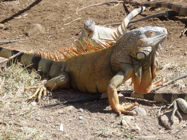
Along the way, we stopped at a place where the iguanas know the buses
bring tourists and treats. There were several ranging from a baby to a very old
one. DJ told us the locals eat them and they "taste like chicken."
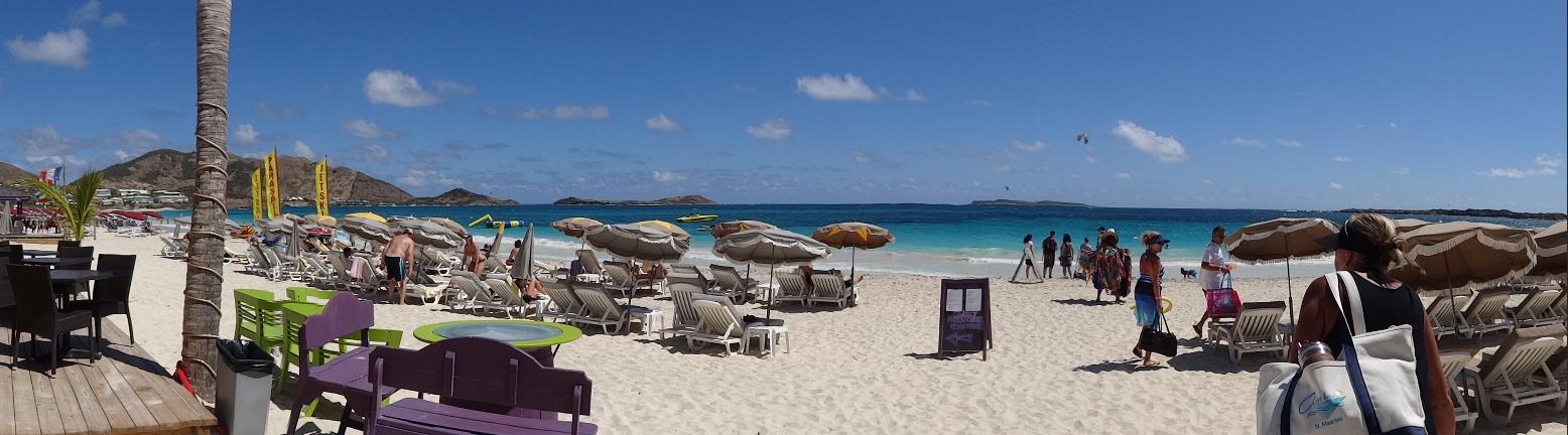
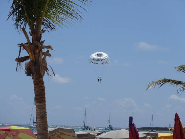
We then went to Orient Bay where we stopped. We were able to use the beach
and facilities at L'Hoste hotel. The beach was packed with sunbathers and a few
swimmers. There was a number of people using parasails to pull them across the
water on surfboards. Others, usually couples, were attached to parachutes and
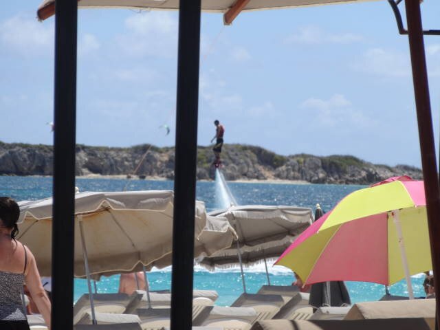
towed by a speedboat until they were aloft. There also was a fellow on a water
jet device in the air. The sand was white, the water various colors from light
blue to deep blue. We sat under a cover to keep cool as the sun was brutal.
Being a resort, we expected the restrooms to to clean. They were not. There was
no running water to wash your hands in the sink!
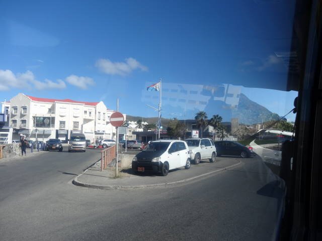
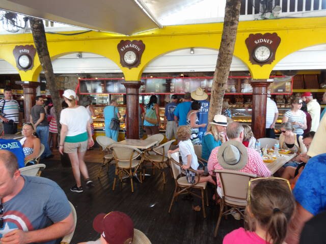
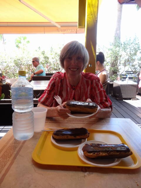
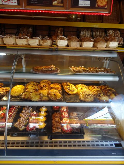
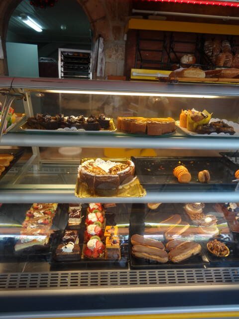
Next we headed to Marigot, the capital of French St. Martin. It is a
pretty place with very clean and picturesque streets. We went to a bakery called
Serafinas where we bought a baguette sandwich of salami and cheese (about
15" long), three chocolate éclairs, and a large bottle of water. The total
price was about €19, or about US$21, a very reasonable price for the
Caribbean! The éclairs were superb! I told Marilyn if we lived on St. Martin we
would want to live in Marigot just because of the bakery!
We then drove back to Dutch Sint Maarten.
Baie de L'Embouchure
Baie from Rotary Lookout Point
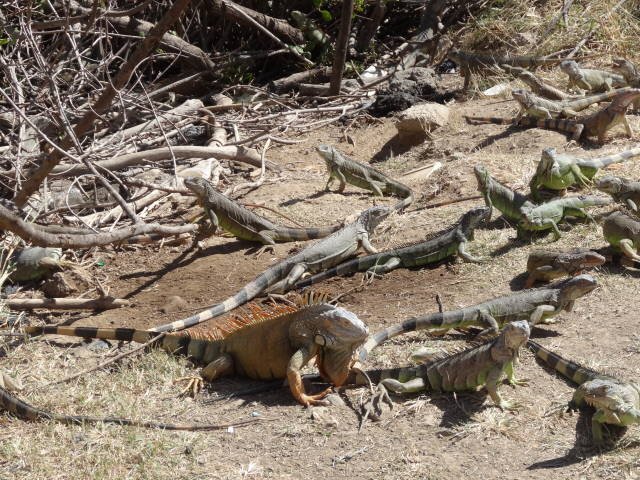
Iguanas at rue de Coralita on Étang aux Poissons
Orient Beach
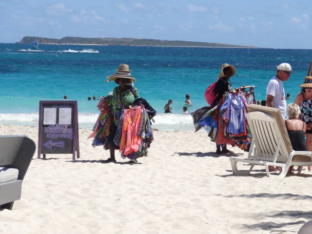
Orient Beach - at right, women selling clothes
Orient Beach
 z\arrigot
Marigot
Margot - Street scene -- Sarafina's Bakery
Sarafina's Bakery